SPC Mesoscale Discussion: New Severe T-Storm/Tornado Watch Not Likely

Probability of Watch Issuance…20 percent
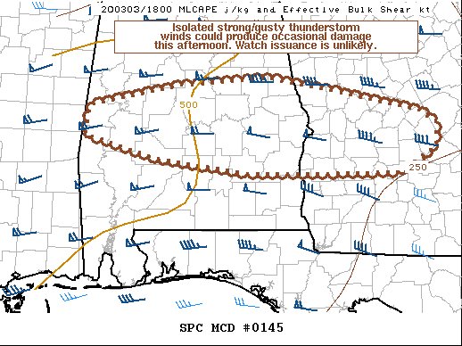
SUMMARY…Isolated strong/gusty thunderstorm winds could produce occasional damage this afternoon. Watch issuance is unlikely.
DISCUSSION…On the southern fringe of large-scale ascent aloft, multiple lines and clusters of shallow storms have formed along/south of a convectively reinforced surface boundary extending west to east across AL/GA. A southern-stream mid-level westerly jet is maintaining 50-70+ kt of flow aloft, as evidenced by recent VWPs from KMXX and KBMX. Recent visible satellite imagery shows low-level cloud bands feeding into the boundary, and a modest uptick in convective intensity has recently occurred. Although cloud cover remains prevalent across much of southern/central AL into southwestern/central GA, some heating has occurred to the south of the surface boundary.
A modest steepening of low-level lapse rates could allow for some of the stronger storms to produce locally gusty winds with occasional damage as they move east-southeastward through the afternoon. One of the cells embedded within a line earlier exhibited weak low-level rotation over northern Montgomery County AL. But, the low-level flow should continue to slowly veer and weaken over the next few hours, with any tornado threat expected to remain rather low. The limited thermodynamic environment, with MLCAPE generally 250-500 J/kg, and storm orientation largely parallel to the surface boundary should preclude a greater severe threat. Accordingly, watch issuance appears unlikely at this time.
Category: Alabama's Weather, ALL POSTS, Severe Weather


