Strong Storm Affecting Portions Of Fayette, Tuscaloosa, & Walker Counties


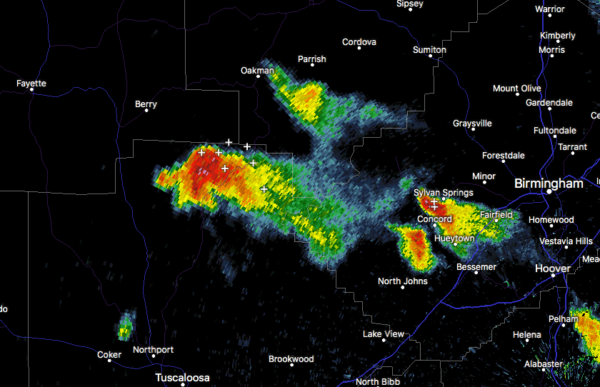
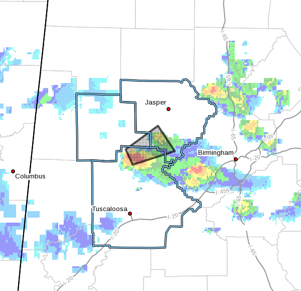
As of 8:21 pm, a strong thunderstorm was located very close to Boley Springs and nearly 20 miles south of Fayette. It is moving to the east at 30 MPH. This storm is capable of producing pea-size hail.
Heads-up if you are in Oakman, Boley Springs, Tutwiler, Whitson, Wiley and The Wye, as this storm is currently affecting you or will move over your location soon.
Another storm was in the southwestern parts of Jefferson County that has grown heavy over the past several minutes. It may also be capable of producing some small hail and gusty winds. Heads-up if you are in Fairfield, Minor, Birmingham, Homewood, Vestavia Hills, and Hoover, as this cell will eventually move over those locations soon.
Category: Alabama's Weather, ALL POSTS


