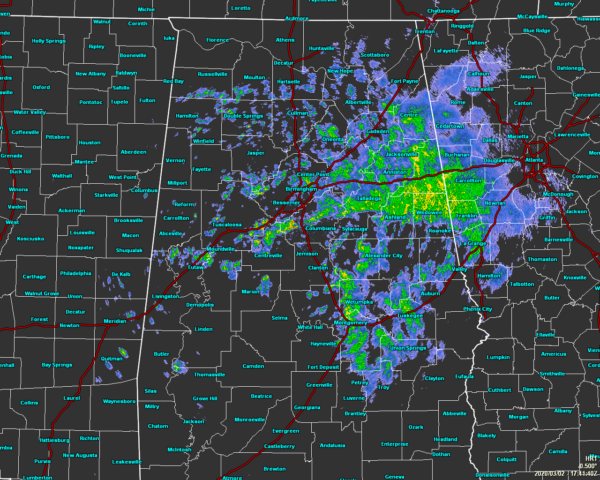
At Midday, Rain Is Mainly Confined To The Eastern Parts Of The Area

As of 11:45 am, we have light to moderate rainfall occurring over the eastern half of the mare mainly just south of the I-20 corridor. There are several smaller light pockets of showers falling over the western half, but most of the locations west of I-65 are dry. Temperatures are currently ranging from the lower 50s to the upper 60s across the area. Multiple locations were tied as the cool spots at 53 degrees while the warm spot was Demopolis at 67 degrees. Birmingham was sitting at 55 degrees.
We’ll continue to have some scattered showers move across the area throughout the rest of the daylight hours, but coverage will not be all that high. There may be a few rumbles of thunder with a few of these showers, but most of these will just be general rainfall. Even with no rain falling, skies will remain cloudy. Afternoon highs will be in the lower 60s to the lower 70s. For tonight, rain chances will be less but a few showers will remain possible across the area. Overnight lows will be in the mid-50s to the lower 60s.
Tuesday will be much of the same as showers will be likely across Central Alabama and cloudy when rain is not falling. The higher concentration of the rainfall will occur over the southern half of the area, but all of the area should receive rain at some point. Highs will reach the upper 60s to the mid-70s. Some thunder can be expected, but severe weather is not likely.

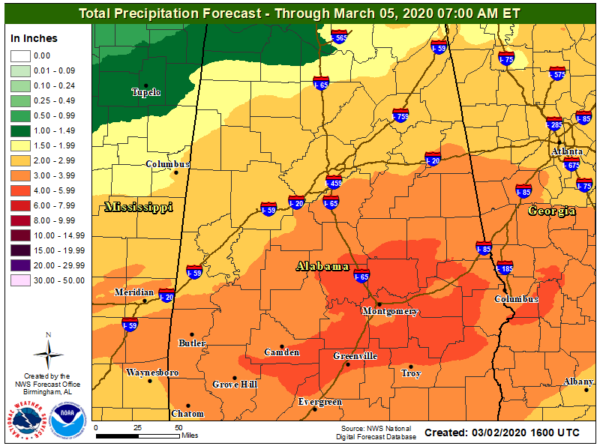
Rainfall from 10:00 am this morning through 7:00 am Thursday morning look to top out ranging from 1.5 inches in the northwestern parts of Central Alabama to as high as 4.00 to 6.00 inches in the southern and southeastern parts of the area. With this prolonged heavy rainfall on already saturated ground combined with elevated river levels, there will be a risk of some flooding mainly south of the I-20 corridor. If you see water covering the roadway or walkway, please do not attempt to cross. Turn around… don’t drown.
Category: Alabama's Weather, ALL POSTS


