March is Roaring In Like A…Lamb!
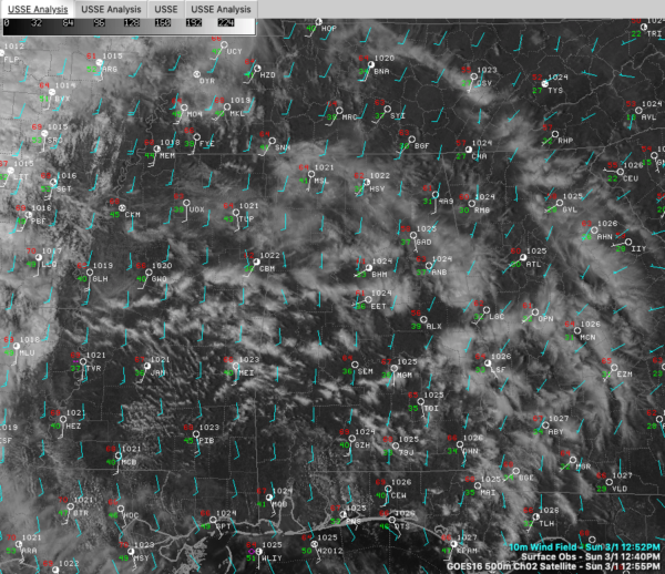
Clouds are increasing across Alabama from the west as moisture surges into the state from the west on a strong upper-level flow.
Temperatures are warming nicely. Birmingham has reached 61F, Tuscaloosa 66F, and Anniston 63F.
Regional radars show a few showers starting to pop up across Tennessee, but Alabama is dry now. I wouldn’t be surprised to see some radar returns before anything starts hitting the ground.
A freshening southerly breeze may gust to 15-20 mph briefly this afternoon, and it will be back for Monday for sure. Lows tonight won’t drop out of the 50s south of US-78/280, and only into the upper 40s over Northeast Alabama.
I would hazard a guess that there might be a pretty good sunset this afternoon, so have those phones ready and don’t forget to @spann. Forget about sending any from eastern Texas, Louisiana, and western Mississippi though as that is where and when the main rain will start to take shape in a powerful low-level southwesterly flow.
The mass of heavy rain will get into Alabama after midnight tonight and will take its time moving across through mid to late morning Monday. Round one rainfall amounts will range from ¾ of an inch to 2 inches, in a stripe defined by US-278 up north and US-80 down south. There will be some embedded thunder, but nothing severe.
The severe threat on Monday, and even it is low end, will be to our northwest, up around Memphis.
We probably get through this without too much in the flooding department, but some local flooding is possible. We probably get a little respite from the rain Monday night gearing up for Tuesday, but bigger problems could ensue Tuesday and Wednesday.
Copious moisture and a steadily approaching cold front will lead to more rounds of rain and thunder on Tuesday. Precipitable water values will be running 200-250% of normal across Central Alabama Tuesday, which is the recipe for very heavy rain. The placement of the heaviest rain will be key. There seems to be good model agreement that areas along and north of I-20 will see between one half and one inch of rain with a stripe of 1-2 inches just to the south of I-20 in places like Clanton, Alex City, and Auburn.
WEDNESDAY LOW: The main surface low will form late Tuesday into early Wednesday it appears. This low will track eastward, spreading another round of rain into Alabama. This will add another 2-3 inches of rain south of I-20, another 1-2 inches in the I-20 Corridor and less than an inch over North Alabama. The rain should end from the west with the passage of the low by Thursday afternoon.
Category: Alabama's Weather, ALL POSTS


