Midnight Update: Rain Showers, Rain, Very Little Lightning
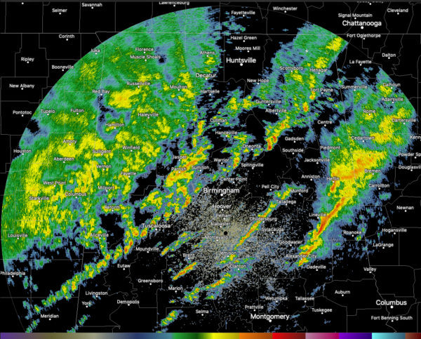
There are three bands of heavy showers ongoing at this hour across the state, with the main more solid rain area into Northwest and West Alabama now.
Here is the radar as of 11:55 p.m.:
You can see that the heaviest rain is over East Alabama’s Clay and Cleburne Counties, near Lineville and Heflin.
There are scattered pockets of heavy rain in the broken line of showers that extends just west of I-59 from DeKalb County to Sumter County.
There is a little bit of lightning over Northeast Alabama, down to northern Jefferson and Blount Counties.
None of the cells are even close to becoming severe and the severe threat is over for tonight.
The flood threat continues, with flash flood watches in effect for much of North and Central Alabama until 6 a.m. Rainfall rates, for now, don’t seem to be getting gout of hand, but prolonged rainfall in the main band may exacerabte flooding problems.
The cold front is on the move and is now east of I-55 in neighboring Mississippi. It should be into Northwest Alabama around 2-3 a.m., the Tuscaloosa/Birmingham areas by 6-7 a.m. but won’t reach Auburn until noon. There could strong to severe storms over far Southeast Alabama from Phenix City down to Dothan during the late morning and early afternoon.
Category: Alabama's Weather, ALL POSTS, Severe Weather


