Severe Weather Threat is Over For Tonight; Flood Threat Still There Though
The severe thunderstorm watch has been canceled.
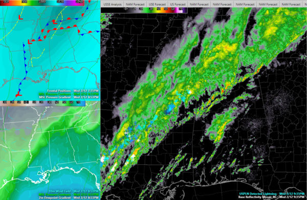
A cold front now over western Mississippi will push into Alabama tonight. More showers and some thunder will continue to push eastward ahead of the front overnight and into early Thursday.
The chance for some rumbles of thunder, heavy rain, and gusty winds will remain.
There is a very strong river of high moisture from the Louisiana Coast northeastward through Central Mississippi into West and North Alabama. This flow, combined with the slower progression of the precipitation means that there is a continued threat of flooding overnight.
Currently, rainfall rates are not too high, but we will continue to monitor.
Lightning rates, that had spiked over Mississippi, seemed to calm down in the past few minutes, which is a good sign.
Category: Alabama's Weather, ALL POSTS, Severe Weather


