Areal Flood Warnings Issued For Portions Of North Alabama

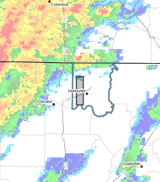
The National Weather Service in Huntsville Alabama has issued a
* Flood Warning for…
Southwestern Madison County in north central Alabama…
* Until 945 PM CST.
* At 544 PM CST, automated rain gauges indicated that Indian Creek
was approaching flood stage, with Doppler radar suggesting that
additional rounds of heavy rain will soon approach the area from
the west. The heavy rain will cause flooding. Up to two inches of
rain have already fallen.
* Some locations that will experience flooding include…
Northwestern Huntsville, Madison, Redstone Arsenal, Triana,
Marshall Space Flight Center and Harvest.

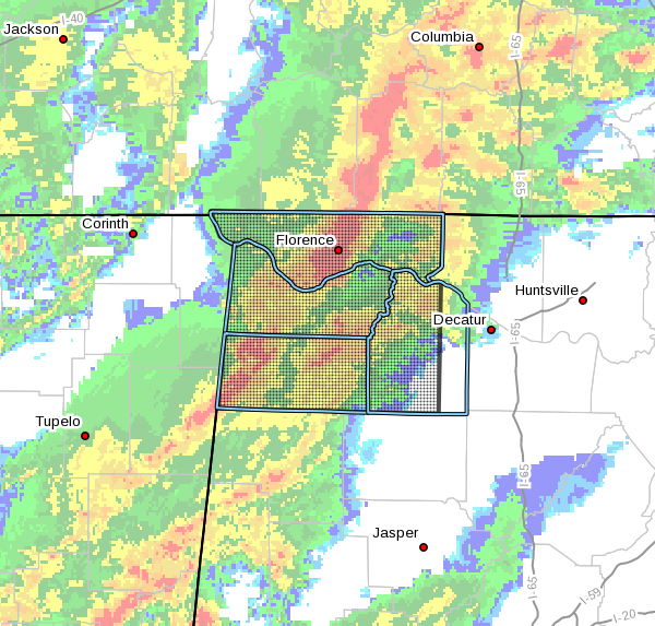
The National Weather Service in Huntsville Alabama has issued a
* Flood Warning for…
Lauderdale County in northwestern Alabama…
Colbert County in northwestern Alabama…
Franklin County in northwestern Alabama…
Lawrence County in northwestern Alabama…
* Until 845 PM CST.
* At 555 PM CST, Doppler radar indicated a line of thunderstorms
producing heavy rainfall progressing eastward across the warning
area. Due to saturated soils from previous rainfall, this slow
moving band of thunderstorms is expected to result in significant
ponding of water on roads and flooding. Up to two inches of rain
have already fallen, with additional rainfall amounts of two to
three inches per hour anticipated within the line of thunderstorms.
* Some locations that will experience flooding include…
Florence, Muscle Shoals, Russellville, Sheffield, Tuscumbia,
Moulton, Red Bay, Rogersville, Phil Campbell and Killen.
PRECAUTIONARY/PREPAREDNESS ACTIONS…
Be especially cautious at night when it is harder to recognize the
dangers of flooding.
Category: Alabama's Weather, ALL POSTS, Severe Weather


