Quick Check At Midday; Tornado Watch Issued To Our West

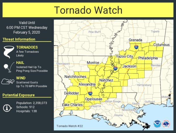
The Storm Prediction Center has issued a TORNADO WATCH valid until 6:00 pm tonight for a good portion of Louisiana and much of the southern half of Mississippi.
Thunderstorms are expected to continue to develop over central Louisiana this afternoon and spread northeastward across the watch area. A few supercell storms are possible, capable of damaging winds and tornadoes.
 Quick Check At Midday
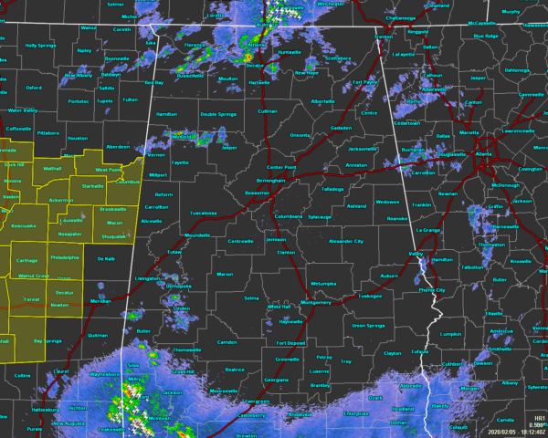
As of 12:12 pm, no severe watches or warnings are in place across North/Central Alabama, but we do have some stronger storms moving across the northern parts of the area and up into Tennessee.
We do still have a little while before we should start to see the main action start to fire up across the area. The good news for North Alabama is that the rainfall from this morning’s activity may hamper the instability to reform over those locations.

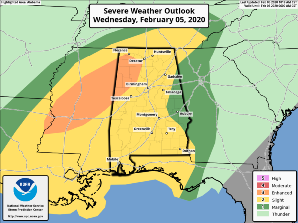
An Enhanced Risk continues for the northwestern parts of the area, mainly encompassing such locations as Tuscumbia, Russellville, Red Bay, Phil Campbell, Addison, Hamilton, Double Springs, Jasper, Fayette, Berry, Sulligent, Vernon, Reform, Aliceville, and points in-between.
The main window for stronger to severe storms will be broad as this is a slower moving system at the moment. For the western parts of the area to as far east as Huntsville to Adamsville to Uniontown, the window is from 3:00 pm this afternoon to 2:00 am Thursday morning. East of that across the I-65 corridor to a line from Ranburne to Alexander City to Fort Deposit will be from 5:00 pm this evening to 4:00 am Thursday morning. The rest of the east and the southeastern parts of the area will be from 7:00 pm tonight to 11:00 am Thursday morning.
It looks like this will come in two separate waves. The first will be this afternoon through the evening hours as a surface low will be moving through the northwestern parts of the area. Supercells and storm clusters with the potential for tornadoes and bowing cells capable of producing winds in excess of 70 MPH are possible. After that, there will be a lull that should allow for instability to reestablish itself over the area and storms becoming organized along and ahead of a cold front that will move in during the late-night through the morning hours on Thursday. Damaging winds and a brief tornado or two will be possible with this wave.
If this system decides to move in any slower, then the threat for stronger storms will persist during the late-night and overnight hours and could possibly lead to an expansion of the Enhanced Risk.

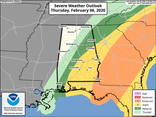
The threat will continue through Thursday morning and should come to an end before the midday hour. All of the southeastern parts of Central Alabama has now been included in a Slight Risk, while the rest of the eastern parts of North/Central Alabama remains in a Marginal Risk. Once again, damaging winds up to 60 MPH and a brief tornado or two remain possible.
Also, a Flash Flood Watch remains in effect through 6:00 pm Thursday for the threat of heavy rains leading to a few flash flooding issues in localized locations, especially if we get training of heavier storms.
We’ll keep you updated throughout the day. Be prepared and stay weather aware.
Category: Alabama's Weather, ALL POSTS, Severe Weather


