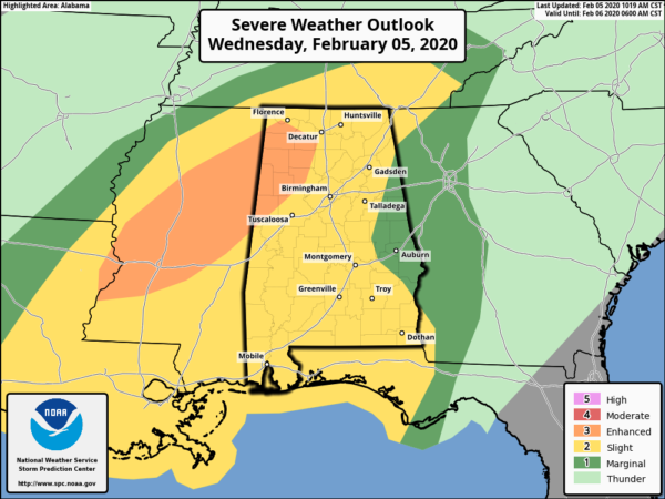
SPC Adds Enhanced Risk To Northwestern Parts Of The Area

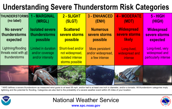
With a very moist airmass in place and a surface low expected to move through the northwestern parts of Alabama this afternoon and evening, the Storm Prediction Center is seeing that the risk for strong to severe storms needed to be raised to Enhanced for those locations.

Latest-model parameters show the potential for stronger low-level shear that could lead to more discrete supercell thunderstorm development along with complex bowing cells. Damaging winds up to 70 MPH and tornadoes will be possible in the Enhanced Risk locations, while a few tornadoes and damaging winds up to 60 MPH will be possible throughout the rest of North/Central Alabama.
Another round of storms will move in later tonight along and ahead of the cold front that could potentially lead to a few supercells capable of damaging winds and a brief tornado or two.

We could continue to see the risk of severe storms after sunrise on Thursday morning through as late as 11:00 am in the east and southeastern parts of the area. A Slight Risk is up for most locations south of I-85
while nearly the rest of the eastern parts of the area is in a Marginal Risk.
We’ll continue to have updates through the event. Be prepared and stay weather aware.
Category: Alabama's Weather, ALL POSTS, Severe Weather


