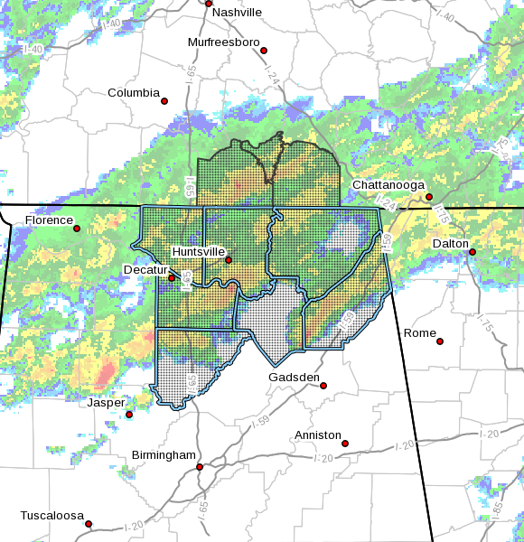
Flash Flood Watch Issued For Parts Of North Alabama Through 6:00 PM Thursday

…FLASH FLOOD WATCH IN EFFECT FROM LATE TONIGHT THROUGH THURSDAY
AFTERNOON…
The National Weather Service in Huntsville has issued a
* Flash Flood Watch for portions of Alabama and southern middle
Tennessee, including the following areas, in Alabama, Cullman,
DeKalb, Jackson, Limestone, Madison, Marshall, and Morgan. In
southern middle Tennessee, Franklin TN, Lincoln, and Moore.
* Through 6 PM CST this afternoon.
* Multiple episodes of showers and thunderstorms producing heavy
rainfall will occur across the region through Wednesday morning.
Due to moist soil conditions, this will result in efficient
runoff and the potential for rapidly rising and swiftly flowing
floodwaters.
PRECAUTIONARY/PREPAREDNESS ACTIONS…
A Flash Flood Watch means that conditions may develop that lead
to flash flooding. Flash flooding is a VERY DANGEROUS SITUATION.
You should monitor later forecasts and be prepared to take action
should Flash Flood Warnings be issued.
Category: Alabama's Weather, ALL POSTS, Severe Weather


