Satellite Sheldon Sees Signs Of Severe Storms Subsequently

Sorry for the alliteration for the title of this post… it just means that our good friend, Satellite Sheldon, sees the signs already beginning to take shape for the potential for strong to severe storms that look to occur starting tomorrow afternoon through Thursday morning.
From Satellite Sheldon…
http://cat.cira.colostate.edu/sport/layered/advected/LPW_alt.htm is the link for our satellite-derived advected layered precipitable water loop that shows one of the best signatures of severe weather now passing across SE Texas this afternoon. You say what signature? Well at the 700-500 layer or bottom left loop, the dry or relative minimum of precipitable water at that layer that came off the Mexican plateau last night and will most likely be heading for at least the Gulf Coastal states in the next two days to help enhance the risk of severe weather. That is called the “elevated mixed layer,” or “EML”. Not a big outbreak, but something this satellite signature is already seeing.

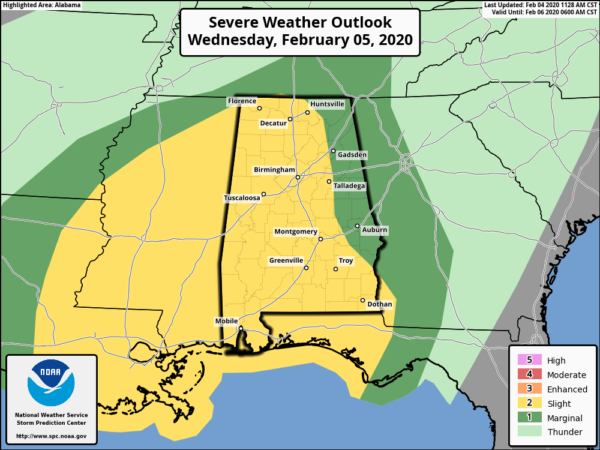
Remember, much of the state is in a Slight Risk for severe storms (level 2 of 5) for the day on Wednesday and through the early morning hours on Thursday, while the east and northeastern parts of the state are in a Marginal Risk (level 1 of 5).

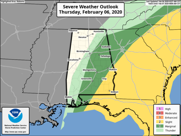
We’re not out of the woods after sunrise on Thursday as nearly the entire eastern half of the state is in a Marginal Risk, while the southeast corner of the state will remain in a Slight Risk until the threat looks to come to an end around 9:00 am.
A few tornadoes and damaging winds up to 60 MPH will be possible throughout the event, with the main window starting around 4:00 pm Wednesday and ending around 9:00 am Thursday.
Category: Alabama's Weather, ALL POSTS, Severe Weather


