A Quick Check On Our Weather At 10:30 AM

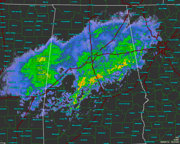
We continue to have a shield of showers and a couple of rumbles of thunder over the central and north-central parts of the area, with the heaviest activity stretching from Marion to Clanton to Ashland and Wedowee. Everything has an eastward component in motion, while the heavier cells are actually pushing to the southeast. Nothing strong or severe at this point, but a bunch of rain that we really don’t need at this point.
All of North Alabama and nearly all of Central Alabama is under a Flash Flood Watch through 6:00 am Wednesday morning.

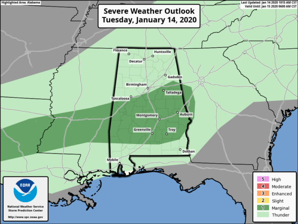
The latest updated graphic from the Storm Prediction Center is out and they have moved the Marginal Risk for severe storms farther south to include all of Central Alabama south along and south of I-20 and I-59/20. Isolated damaging winds and hail are the main threats. We do not expect to see any tornadoes with this event.
We’ll continue to see widespread showers and thunderstorms throughout the daytime hours with the coverage dropping to scattered to numerous in coverage during the evening and overnight hours. A few storms could become strong with gusty winds and some hail. Rainfall will probably be more of a nuisance than the strong storms. Highs will get up into the upper 60s to the mid-70s while lows will only drop into the lower to mid-60s.
Category: Alabama's Weather, ALL POSTS, Severe Weather


