Latest Mesoscale Discussion On Southeastern Parts Of Central Alabama

The severe weather threat for Tornado Watch 13 continues.
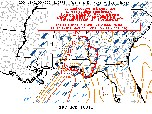
SUMMARY… Isolated severe risk continues across southern portions of Tornado Watch 13. A downstream watch into parts of southwestern GA, far southeastern AL, and more of the Florida Panhandle will likely be needed in the next hour or two (80% chance).
DISCUSSION… The southern portion of an extensive squall line extending across much of AL has struggled to intensify this afternoon, with only isolated damaging wind reports received over the past several hours across southern AL. This may be due to the stronger large-scale forcing attendant to an upper trough remaining generally displaced to the north of southern AL and the western FL Panhandle. Still, the environment downstream of the ongoing line remains favorable for severe storms, with MLCAPE around 500-1000 J/kg and 50-60+ kt of effective bulk shear present. Isolated to scattered damaging winds should remain the primary threat with mainly a linear mode observed, with the best potential existing with any northeastward-moving bowing segment embedded within the overall line. Brief/isolated tornadoes also remain possible as the VWP from KEVX shows nearly 50 kt of 0-1 km shear, and mesoanalysis estimates 400-500 m2/s2 of effective SRH ahead of the line. Based on recent radar trends, a downstream watch into parts of southwestern GA, far southeastern AL, and more of the FL Panhandle will likely be needed in the next hour or two, with 80% chance of issuance.
Category: Alabama's Weather, ALL POSTS, Severe Weather


