SPC Mesoscale Discussion States Threat Will Be Maximized Over Next Few Hours

The severe weather threat for Tornado Watch 13, 15 continues.
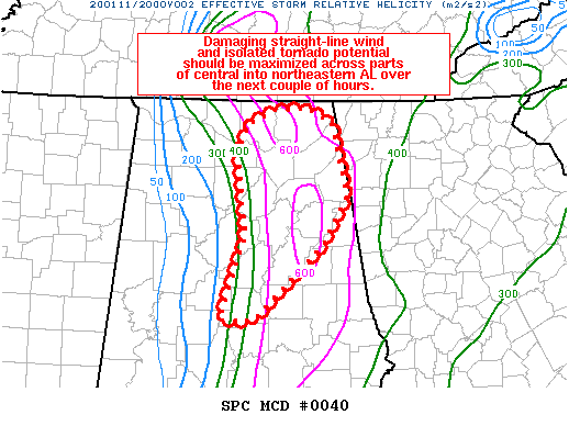
SUMMARY… Damaging straight-line wind and isolated tornado potential should be maximized across parts of central into northeastern AL over the next couple of hours.
DISCUSSION… A mature squall line that has a history of producing damaging straight-line winds and embedded tornadoes is moving east-northeastward around 40-50 kt across central into northeastern AL. Although diurnal heating has been stunted by widespread cloud cover, surface temperatures have warmed into the low to mid-70s across this area, with surface dewpoints generally in the low to mid-60s. An 18Z special sounding from KBMX just ahead of the line shows the temperature inversion around 700 MB has almost completely eroded, with about 340 J/kg of MLCAPE present. The observed wind profile also shows very favorable low to mid-level shear that will help maintain storm organization for at least the next couple of hours. Effective SRH around 450-600 m2/s2 will likely foster continued low-level circulations embedded within the line, with isolated tornado potential. Otherwise, straight-line winds of 50-70 mph along the length of the squall line will continue to produce damage through the afternoon. Portions of the line that are oriented more orthogonal to the southwesterly mid-level flow will likely have the greatest strong to severe wind potential (such as the bowing segment moving from Jefferson, St. Clair, and Blount counties into northeastern AL).
Category: Alabama's Weather, ALL POSTS, Severe Weather


