Tornado Watch Coming Soon For Parts Of North/Central Alabama

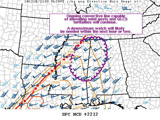
From the Storm Prediction Center: A strong convective line capable of damaging wind gusts and tornadoes will continue across northeast/east-central MS into northwest/west-central AL over the next few hours. A downstream watch will likely be needed across northwest/west-central AL within the next hour or two.
The convective line moving through northern MS has recently shown increased forward motion to around 45 kt. At this speed, this portion of the line will likely reach the MS/AL border around 2200Z. Instability is expected to be modest, tempered primarily by cooler surface temperatures (i.e. low 70s) and warm mid-level temperatures. That being said, a remnant of the EML will still exist and deep-layer shear is expected to be very strong (60+ kt from 0-6 km). Additionally, the strongest part of the low-level jet will be focused across the region from west-central MS into middle TN. The conditions suggest the ongoing line should persist as it moves across northeast/east-central MS and into northwest/west-central AL. Damaging wind gusts are likely with tornadoes embedded within the line also possible. A Watch will likely be needed across portions of northwest/west-central AL within the next hour or two.
Category: Alabama's Weather, ALL POSTS, Severe Weather


