All Quiet For Alabama At Midday; Action Picking Up To Our West

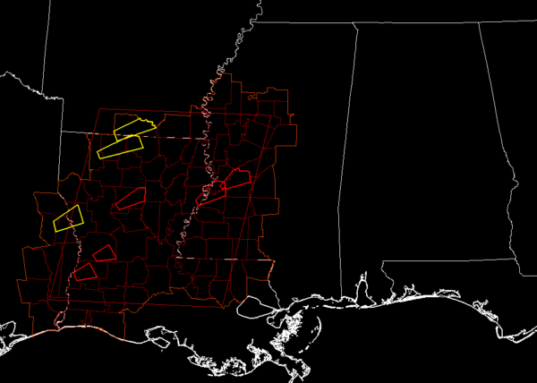
Action has really picked up to our west and southwest as there are five active tornado warnings and three active severe thunderstorm warnings in parts of Mississippi, Louisiana, Arkansas, and Texas. A tornado watch continues until 6:00 pm tonight.

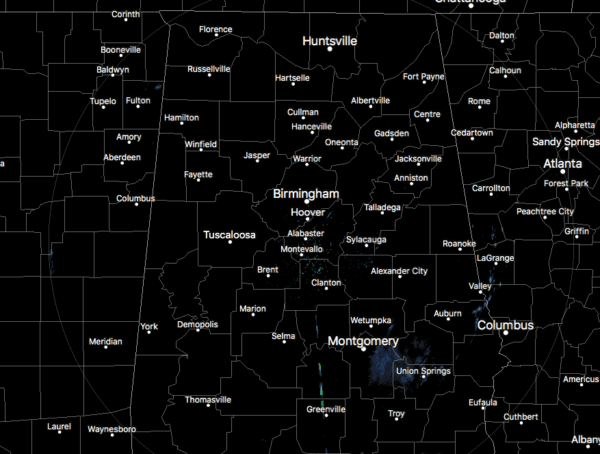
Nothing going on across Central Alabama as of 12:00 pm as the radar is mainly free from any rain or thunderstorms. There may be a few raindrops falling over the southeastern parts of the area but those look to be far and few between. Temperatures are already up into the mid-60s to the mid-70s across the area. Auburn was the cool spot at 64 degrees while a few locations were tied at 75 degrees as the warm spots. Birmingham was at 70 degrees.
So far, nothing has changed in our thinking with the severe weather threat across the area for later today through the morning hours on Tuesday. All parameters continue to show that we will have the potential for tornadoes, damaging straight-line thunderstorm wind gusts up to 70 MPH, and golf ball size hail.

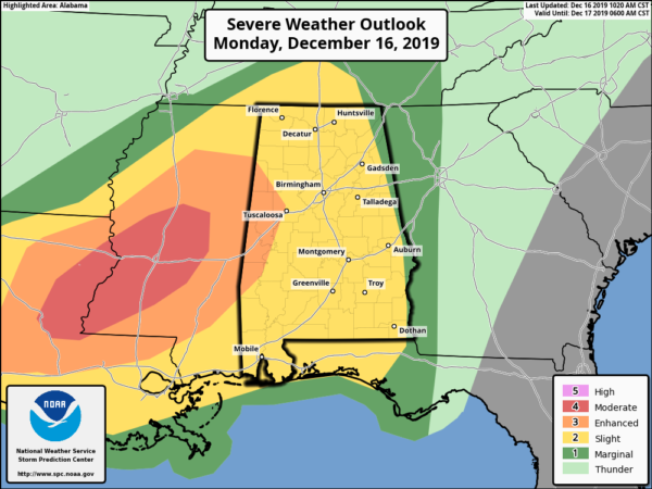
An Enhanced Risk for severe storms continues for the western and southwestern parts of the state mainly for locations west of a line from Detroit (Lamar Co.) to Northport (Tuscaloosa Co.) to Forkland (Greene Co.).
A Slight Risk continues for much of the rest of North/Central Alabama with the exception of locations along and east of a line from Pisgah (Jackson Co.) to Woodland (Randolph Co.) to Eufaula (Barbour Co.). Locations east of that line continue in a Marginal Risk.
Timing for stronger to severe storms should start around 4:00 pm in the western and northwestern parts of the area, moving into the central parts of the area by 7:00 pm, and moving into the east and southeastern parts of the area by 11:00 pm. All severe weather should be completely out of the area by 7:00 am on Tuesday morning.
We’ll have to watch for the potential of a stronger tornado or two in the Enhanced Risk locations as the Storm Prediction Center has those locations defined in a 10% or greater probability of EF2-EF5 tornadoes within 25 miles of a point. We may see supercells develop out ahead of the main broken line of cells where the potential would be greater for the formation of tornadoes. Damaging winds will have a higher probability within the line of cells, especially if there are any bowing segments.
The atmosphere will continue to destabilize throughout the day as more moisture continues to be pulled up into North/Central Alabama, especially with temperatures already up into the 70s. Dewpoints will continue to rise and should make it into the mid to upper 60s.
Continue to keep up to date with us throughout the day and when the event starts this afternoon. Also, have multiple ways of receiving warnings. Go ahead and activate those WEA alerts on your smartphone if you have them turned off. Be smart and be prepared. Have those safety kits and your safe place ready to go just in case a warning is issued for your location.
Category: Alabama's Weather, ALL POSTS, Severe Weather


