Snow Continues Over Parts of North Alabama; Brighter/Drier Tomorrow
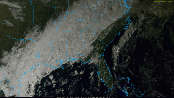
COLD, WET DECEMBER DAY WITH SOME SNOW OVER NORTH ALABAMA: As advertised early this morning, temperatures have been falling steadily across Alabama today following the passage of a cold front, and temperatures are in the mid 30s over the northern third of the state. In that cold air, snow has been falling at times over the past few hours, but so far there has been no impact and little accumulation. We will continue to forecast periods of light snow over the northern quarter of the state tonight (mostly north of U.S. 278, or north of a line from Hamilton to Cullman to Gadsden)… light accumulation (1 inch or less) is possible on some grassy spots, but the roads will remain wet. Keep in mind the ground is still very warm.
Temperatures will hold in the mid 30s this evening, but they slip below freezing late tonight. The precipitation will be over by then, but there could be a few icy spots on bridges or overpasses where puddles of water linger. But, the overall impact will be low and travel won’t be greatly impacted. We expect no snow or winter weather issues for Central Alabama.
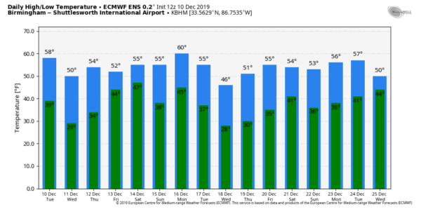
REST OF THE WEEK: Tomorrow will feature a good supply of sunshine over the northern half of Alabama with a high in the low 50s, but clouds will linger over far South Alabama, where a few showers are possible. Thursday will be dry with a mix of sun and clouds, but clouds move in late in the day, and rain will begin again Thursday night. Friday looks wet with rain statewide, ending from the west to east during the midday and afternoon hours thanks to a wave of low pressure moving out of the Gulf of Mexico. Some thunder is possible Friday, but severe storms are not expected.
THE ALABAMA WEEKEND: For now most of the weekend looks dry across the state, with mixed sun and clouds Saturday and Sunday. The high Saturday will be in the low 60s, followed by mid 60s Sunday. Clouds will thicken Sunday night.
NEXT WEEK: Another wet weather system will bring rain to Alabama Monday, Monday night, and Tuesday morning; looks like one inch of rain can be expected then, followed by drier and colder weather through mid-week. See the Weather Xtreme video for maps, graphics, and more details.
ON THIS DATE IN 2012: An EF1 tornado moved through the northern part of Birmingham… The tornado touched down just east of the Birmingham Farmers Market. From there, it moved to the northeast across a light industrial warehouse area, striking a large metal building. Several overhead doors at the loading dock were blown in, which then blew out about 25 percent of the roof off the building. Debris from this structure was found up to a mile away. The tornado continued northeastward through a residential area, causing damage to 29 homes, 2 of which had major damage and one of which lost its roof entirely. A church and two other businesses were damaged near the intersection of Finley Blvd and 16th Street. The tornado lifted near the intersection of 24th Court North and 18th Street North, just west of Interstate 65. There were no injuries.
BEACH FORECAST: Click here to see the AlabamaWx Beach Forecast Center page.
WEATHER BRAINS: Don’t forget you can listen to our weekly 90 minute show anytime on your favorite podcast app. This is the show all about weather featuring many familiar voices, including our meteorologists here at ABC 33/40.
CONNECT: You can find me on all of the major social networks…
Facebook
Twitter
Instagram
Pinterest
Snapchat: spannwx
Look for the next Weather Xtreme video here by 7:00 a.m. tomorrow….
Category: Alabama's Weather, ALL POSTS, Weather Xtreme Videos


