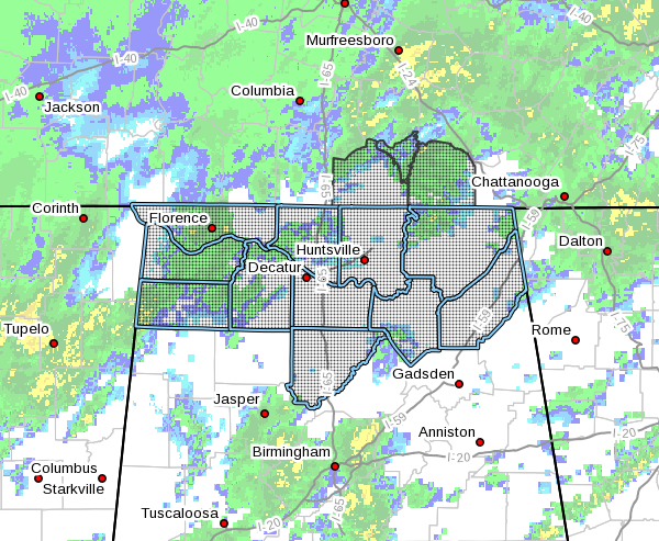
Significant Weather Advisory Issued For North Alabama Through 10:00 AM Wednesday

Significant Weather Advisory for Light Snowfall Across Northern Alabama and portions of southern middle Tennessee through 10 AM on Wednesday.
From NWS Huntsville:
A transition of rain to a wintry mix of precipitation will affect portions of southern Tennessee and northwestern Alabama early this afternoon. As this front continues to slowly move further south this afternoon, this transition will occur further south. By the mid-afternoon hours, this mix should shift further south to near the Tennessee River. Further south, expect this mix to begin by late afternoon or early evening hours. This precipitation should become all snow in most locations during the late afternoon/early evening hours, before ending just after midnight.
Snow accumulations, kept lower by warm ground temperatures, look light at this time. Some refreezing of liquid precipitation is possible on mainly elevated and grassy surfaces from this afternoon until around 10 AM on Wednesday. Total snow accumulations will range from a trace to one half of an inch for most of northern Alabama. Areas near and north of a line from Scottsboro to Decatur, could receive one half of an inch to one inch of snow. Locally higher amounts are possible, primarily in the more elevated portions of the Cumberland Plateau around Sewanee, Tennessee. Post frontal snow will wind down from northwest to southeast shortly after midnight, as drier air filtering in helps to end the precipitation.
Although widespread accumulations or travel problems are not anticipated, use caution when traveling on elevated roadways, bridges, and overpasses this afternoon through 10 AM on Wednesday.
Category: Alabama's Weather, ALL POSTS, Winter Weather


