A Quick Check On Our Situation At Midnight

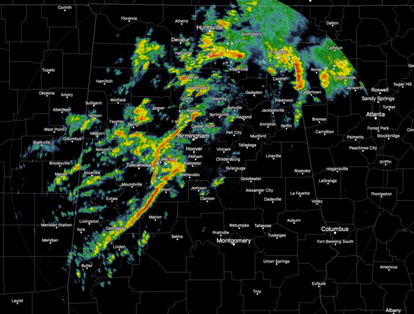
As we approach the midnight hour across North/Central Alabama, we continue to have a ragged line of showers and storms affecting the central and southwestern parts of the area, with another broken batch of storms up in the north-central and northeastern parts of the area. No storms are severe and no watches are in effect, but a few of these storms are packing gusty winds, heavy rain, and dangerous lightning.
We continue to have a Marginal Risk for all of Central Alabama that is along and east of a line from Cullman to Northport to Demopolis with the main window for stronger to severe storms across the risk area from now until 7:00 am this morning. For locations west of that line, the severe threat is over.

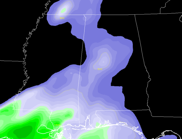
Surface-based instability values have climbed over 500 J/kg in the west-central parts of the area and this is where the stronger storms are currently occurring. Helicity continues to be relatively high, and couple that with the available instability and higher amounts of shear, we still have a low potential for damaging winds and a brief spin-up tornado or two.
Significant tornado parameters are only topping out around or just over 1.0 at this point over the west-central and southwestern parts of the area and is only expected to slowly decline as we go through the remainder of the event.
I’ll be back with any warnings if issued.
Category: Alabama's Weather, ALL POSTS, Severe Weather


