A Quick Check On Our Weather At Midnight

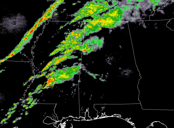
As we approach the midnight hour across North/Central Alabama, we have showers over the northwestern corner of the state while pretty much the rest of the area remains dry. The good news for tonight’s threat for stronger to severe storms is that the National Weather Service has canceled all tornado watches that were in effect across Mississippi and back into Arkansas and Louisiana.
At this point, there is no surface-based instability over the area as much of it still remains over the southwestern and western parts of Mississippi and back over southern Arkansas and all of Louisiana. It will take around 2-4 hours for any instability to move into the western parts of North/Central Alabama, but we don’t expect much at all.
The cold front is located just west of the Mississippi River where there is a backline of storms that will be moving into the northwestern parts of Mississippi within the next 30-60 minutes.
There is one tornado warning in effect of parts of Rankin County in Mississippi along with a severe thunderstorm warning in effect for parts of Rankin, Copiah, and Simpson counties. Both of those are set to expire at 12:30 am.
We do have a good bit of shear moving into the western half of the area with values reaching as high as 55 knots. Helicity is starting to rise as well, but the larger values of 400-500 m2/s2 still remain over much of Mississippi. Those higher values will move in over the next 2-4 hours. Therefore, we will keep a non-zero threat of isolated damaging winds up to 60 MPH and a brief tornado in the forecast through 7:00 am Wednesday morning.

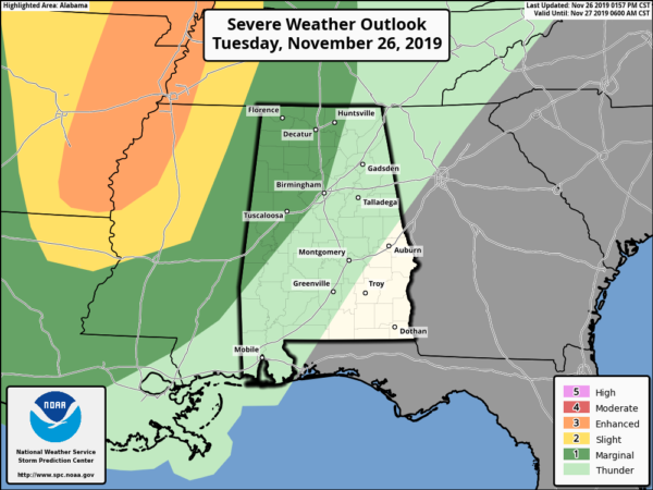
The Storm Prediction Center still has a Marginal Risk for severe storms up for locations west of a line from New Hope to Birmingham to Demopolis. The Enhanced Risk shown in the graphic is no longer in effect.
Category: Alabama's Weather, ALL POSTS, Severe Weather


