Old Man Winter Unleashes Some Nasty Cold Air For Early Next Week

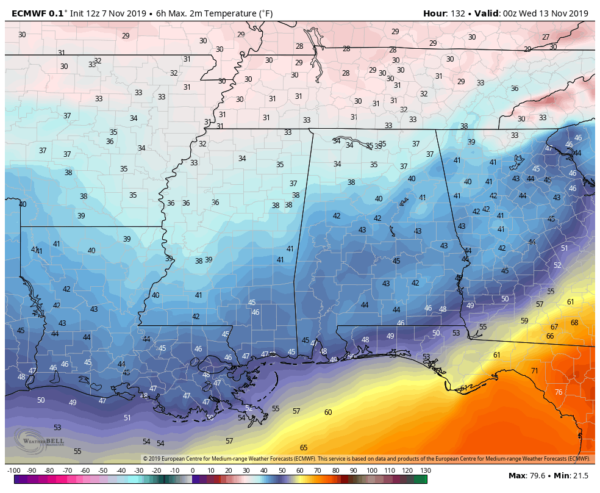
After we have a cold front move through the area during the late-night on Monday and into the pre-dawn hours on Tuesday, we’ll need to be ready for the Arctic blast that will be hitting us on Tuesday. The latest complete run of the European model continues to show temperatures topping out in the mid-30s to the lower 40s across Central Alabama from northwest to southeast during the afternoon hours. Also, don’t be surprised if you see a few sleet pellets or snow flurries on the backside of the rain shield as it moves through during the early morning hours. There will be no travel issues as temperatures will stay above freezing through the daylight hours.

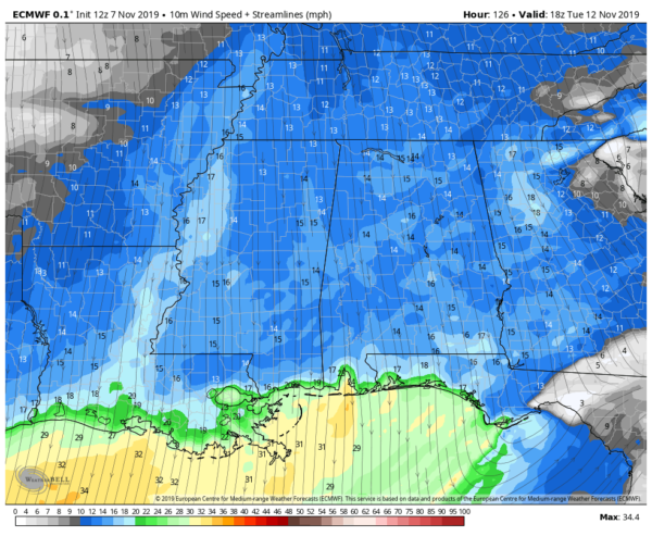
If that wasn’t bad enough with it just being very cold, winds will be cranking out of the north with gusts as high as 30 MPH possible, with the average wind speed ending up around 15 MPH. With that being the case, we could see wind chills during the warmest part of the day only in the upper 20s to the mid-30s. I don’t know about you, but I wasn’t ready for Old Man Winter to show up quite yet.

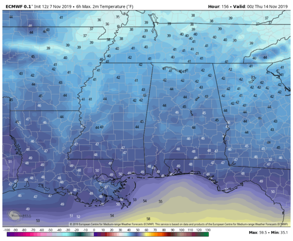
News is only a little better for Wednesday as the wind will not be as bad, but we could still have some gusts as high as 15 MPH at times out of the north. Daytime highs look to top out in the lower to mid-40s across the area and wind chill values could be held back in the mid to upper 30s.
The good news after that is we’ll be back up in the 50s for highs on Thursday and Friday. We’ll still have to watch for overnight lows in the 30s, so we may have to deal with some frost in the colder locations.
Be sure to have those plants covered and taken care of, and that your outdoor pets have a good warm place to sleep during the night. Have your pipes insulated and don’t forget to leave a small drip going in your faucets.
Category: Alabama's Weather, ALL POSTS, Winter Weather


