Tornado Watch Possible For Extreme Southwest Alabama, Including The Alabama Gulf Coast

SUMMARY
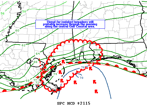
The threat for isolated tornadoes is expected to increase along the central Gulf Coastal area through the morning and continue into the afternoon. Trends are being monitored for a possible tornado watch. The possibility of a watch is at 60%.
DISCUSSION
As of mid-morning a warm front extends along the central Gulf Coast then southwestward into southeast Louisiana and is expected to move slowly northward through the morning. As a result, a very moist warms sector with low 70s F dewpoints will advect inland resulting in modest instability (1000-1500 J/kg MLCAPE). Meanwhile, discrete storms including a few supercells, are developing along convergence bands over the Gulf that extend northward, intersecting the warm front along the central Gulf Coast. A mid-level shortwave trough preceding the primary upper trough will advance northeast through the north-central Gulf region today. A 35-40 kt low-level jet will persist downstream from this feature, maintaining favorable 0-1 km hodographs for low-level mesocyclones and a few tornadoes, especially as storms interact with the warm front. The short-term tendency might be for storms to weaken as they move onshore, confining the tornado threat to near the coast. However, the trend should be for storms to survive farther inland as the warm front moves north through midday.

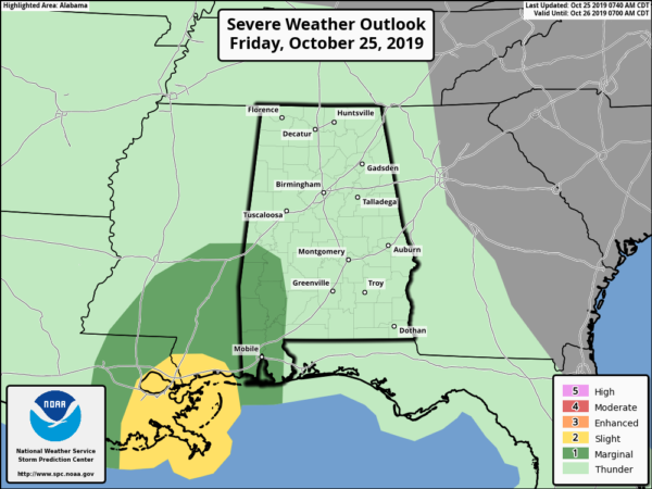
SPC has introduced a Marginal Risk of severe storms throughout the day and night time hours for the southwestern parts of the state including Mobile, Baldwin, Washington, Clarke, and Choctaw counties, much of Marengo County, and the southern half of Sumter County.
Category: Alabama's Weather, ALL POSTS, Severe Weather, Tropical


