Could We See A Depression Or Storm Over The Gulf Before The Weekend?

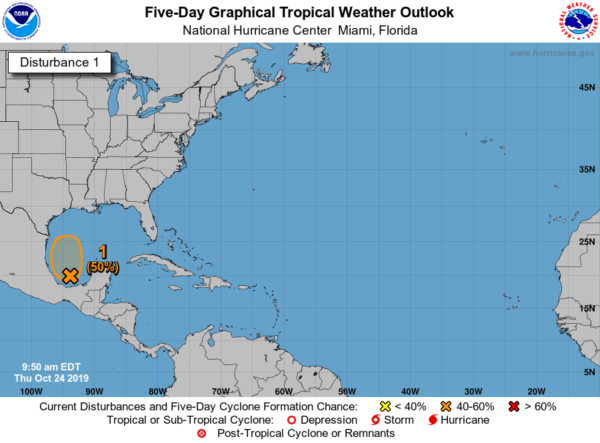
We have a disturbance over the Bay of Campeche that is starting to show signs of better organization and definition. There is a possibility that this could become a tropical depression or a low end tropical storm before it merges with a cold front on Friday evening. At this point, NHC is giving it a 50/50 shot of becoming a depression.
While the disturbance is expected to be absorbed into the front, some of that energy will work up into parts of Alabama and will enhance rainfall for parts of the area. We may have some wind gusts up to 30 MPH, but most of that will be with the front itself.
For the Gulf Coast, some rough seas and gusty winds up to 30-40 MPH may occur from Pensacola to the Louisiana Gulf Coast. The main story will be more focused on the heavier rainfall that is expected through Sunday.

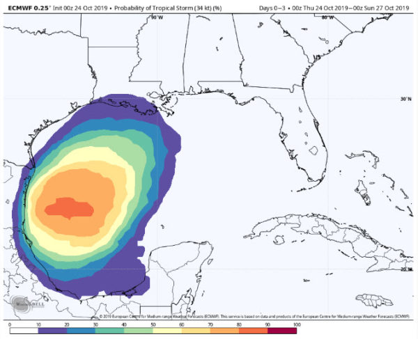
The latest run of the European model shows a pretty high chance of tropical-storm-force winds occurring between now and the end of the day on Saturday. The darkest shade of orange is an 80-90% chance of those winds occurring in that general location.

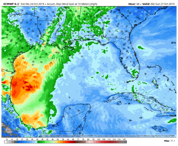
This image shows the maximum wind gusts expected between now through the end of the day on Saturday. There could be some wind gusts of up to 60 MPH over the western Gulf of Mexico when the disturbance interacts with the cold front. Fortunately, the front looks to stretch the disturbance’s energy out along the southern part of the front which will somewhat dissipate winds for the southeast, but some gusts up to 40 MPH could be possible in Central Alabama with the passage of the front.

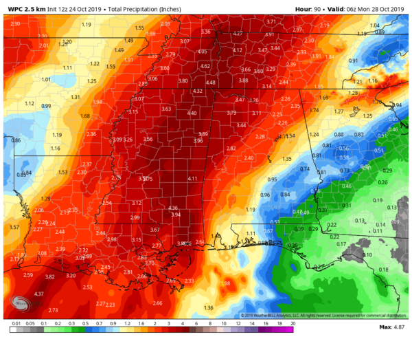
While we don’t like to have rain on our weekends so we can get outside and do some fun activities or catch up on our yard work, the rain we are forecast to get could put a huge dent into our drought situation. Forecast rainfall totals through midnight Sunday night from the WPC shows a wide range from as low as nearly 1/2-inch in the southeastern corner of the state to as high as over 4 inches for the northwest corner of the state.
Much of the disturbance’s energy that will be absorbed into the front and will move northward along the front rather rapidly, enhancing rainfall where it passes. That energy looks to pass through the extreme western and northwestern parts of the state during the late night hours on Saturday through the early morning hours on Sunday.
No organized severe weather is expected with this combo system and tropical disturbance, but we could see a few stronger storms with gusty winds. We’ll keep you updated through the rest of the week and weekend.
Category: Alabama's Weather, ALL POSTS, Tropical


