Tropical Update: I See You A Hurricane & Raise You Two Tropical Depressions
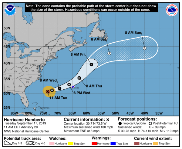
Hurricane Humberto continues to move away from the US mainland with maximum sustained winds now up to 100 MPH. Hurricane watches have been issued for Bermuda as the eye of Humberto will pass just to the north of the island on late Wednesday night. Rough surf and dangerous rip currents will continue to affect the Atlantic Coast of the southeast US for the next couple of days.
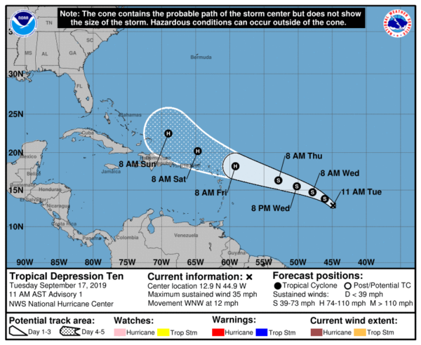
Tropical depression ten has formed over the central parts of the Tropical Atlantic Ocean. Current forecast track has it becoming Tropical Storm Imelda possibly as early as late this afternoon or into the evening hours. Movement is to the west-northwest and will approach the Leeward Islands by Thursday night or Friday morning, possibly as a hurricane. Most of the members of the ensemble have it curving back around to the north and away from the US Mainland, but there are a few that have it continuing on to the west-northwest. Just too early to tell at this point. We’ll have to keep our eye on this one.
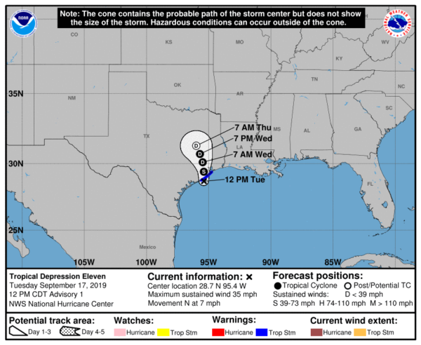
Tropical Depression Eleven has just formed over the northwestern parts of the Gulf of Mexico and will be making landfall on the Texas Gulf Coast later today and into tonight. A Tropical Storm Warning has been issued for the coast of Texas. TD-11 could become a tropical storm before landfall. The main story will be the amount of rainfall for the upper coastal parts of Texas and into the far southwestern parts of Louisiana, as 5-10 inches are possible with isolated totals up to 15 inches possible. Life-threatening flash floods will be possible with this disturbance.
Category: ALL POSTS, Severe Weather


