7 p.m. Update on Hurricane Dorian: Dorian Continues to Move Away from Puerto Rico and the Virgin Islands
QUICK FACTS
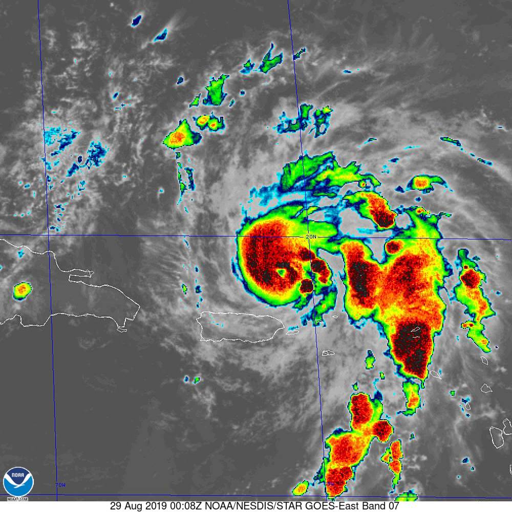
SUMMARY OF 700 PM CDT…0000 UTC…INFORMATION
———————————————-
LOCATION…19.2N 65.7W
ABOUT 60 MI…95 KM NNE OF SAN JUAN PUERTO RICO
MAXIMUM SUSTAINED WINDS…80 MPH…130 KM/H
PRESENT MOVEMENT…NW OR 325 DEGREES AT 13 MPH…20 KM/H
MINIMUM CENTRAL PRESSURE…990 MB…29.23 INCHES
Hurricane Dorian continues to strengthen tonight and has become well organized. The presence of the organization, warm water, and low shear means that the strengthening will likely continue.
Top winds are now 80 mph and are expected to increase steadily until Saturday, and they should hold steady until landfall Sunday night on the east coast of Florida. The expected turn to the west is in anticipation of a building ridge of high pressure to the north of the hurricane. This track would lead to the storm emerging over the northeastern Gulf of Mexico Monday night with another landfall somewhere along the Gulf Coast. The operational run of the European shows a landfall on the western Florida Panhandle next Thursday. The GFS is further north, moving the storm onshore and they slowly turning it northeast over southern Georgia and northern Florida. This would, of course, result in tremendous rains over that area.
The eventual track is of great concern for residents and visitors to the Gulf Coast on the busy Labor Day weekend. We will be updating things every 6 hours through Dorian’s demise.
On a side note, Erin weakened to a tropical depression and is expected to lose tropical characteristics tonight.
About the Author (Author Profile)
Bill Murray is the President of The Weather Factory. He is the site's official weather historian and a weekend forecaster. He also anchors the site's severe weather coverage. Bill Murray is the proud holder of National Weather Association Digital Seal #0001 @wxhistorianSubscribe
If you enjoyed this article, subscribe to receive more just like it.


