Saturday Morning Notes On TS Barry
A few notes this morning on Tropical Storm Barry…
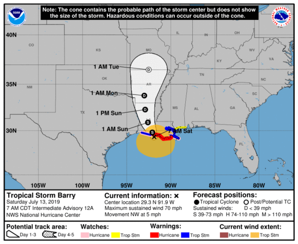
*Sustained winds are now 70 mph, and on the forecast track, the center of Barry will make landfall along the south-central Louisiana coast during the next several hours.After landfall, Barry is expected to move generally northward through the Mississippi Valley through tomorrow night. Barry is expected to be a minimal hurricane when the center reaches the Louisiana coast during the next several hours. Steady weakening is expected after Barry moves inland.
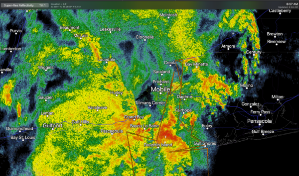
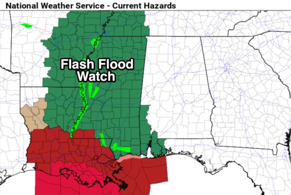
*Soaking rains are falling this morning along the Alabama Gulf Coast; a flash flood watch remains in effect for Mobile, Baldwin, Washington, and Choctaw counties in Alabama, and all of Mississippi.
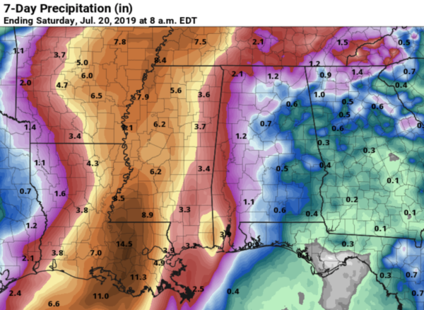
*The inland track of Barry has been adjusted westward, meaning a shift in the forecast of significant rain. The most significant rain will be over far West Alabama, near the Mississippi border, where three inches are possible through the weekend. Amounts over the central counties will be around 1/2 to one inch, with amounts under 1/2 inch over East Alabama.
Remember there will always be some big variability with summer rain events, even with a tropical system. Our Skywatcher at Black Creek, just northeast of Gadsden, reported 4.28″ last night, all coming in only two hours. A deep layer of tropical moisture is over Alabama, on the east side of Barry, and showers this afternoon and tonight will be very efficient rain producers.
*The best chance of rain for inland parts of Alabama will come during between noon and midnight today and tomorrow.
*With the westward shift in the track of Barry, we expect no tornado threat in Alabama.
*Weather conditions will improve along the Gulf Coast tonight and tomorrow, although bands of rain and storms will persist from near Pensacola westward. Next week should feature fairly routine summer weather with the rip current danger lessening.
Keep an eye on the blog for forecast updates through the weekend…
Category: Alabama's Weather, Tropical


