Quick Check of the Radar at 2 p.m.
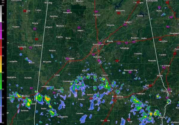
One of the outer bands of tropical storm Barry is pushing northward across Central Alabama at this hour.
Heavy showers and some lightning extend along an arc from York and Demopolis in West Alabama to near Maton, Clanton, and Wetumpka in Central Alabam on to near Union Springs and Eufaula in East Alabama. The activity is pushing northward at some 15-20 mph but is beginning to weaken. It will send an outflow boundary northward which will trigger other showers and storms across the middle of the state over the next few hours.
A few showers have shown up over West Central Alabama’s Pickens county. They are moving northwest.
There are showers and storms across North Alabama in the vicinity of a weak stationary front.
Another outer band is pushing up into Southwest Alabama as well.
This will continue to be the trend through the next 48 hours as Barry moves inland and pushes up through Louisiana and Arkansas by late Sunday.
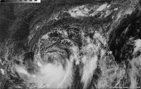
Tropical Storm Barry continues off the southern Louisiana coast this afternoon. The Air Force plane found a central pressure of 993 millibars in one of the swirls rotating around the center. Thunderstorms continue to try to develop around the center of the storm. Slow intensification should continue through the next 18 hours before the storm is on land. It is expected to be a minimal hurricane when it does.
Category: Alabama's Weather, ALL POSTS


