Barry May Be Getting Better Organized, Still May Reach Hurricane Intensity Before Landfall
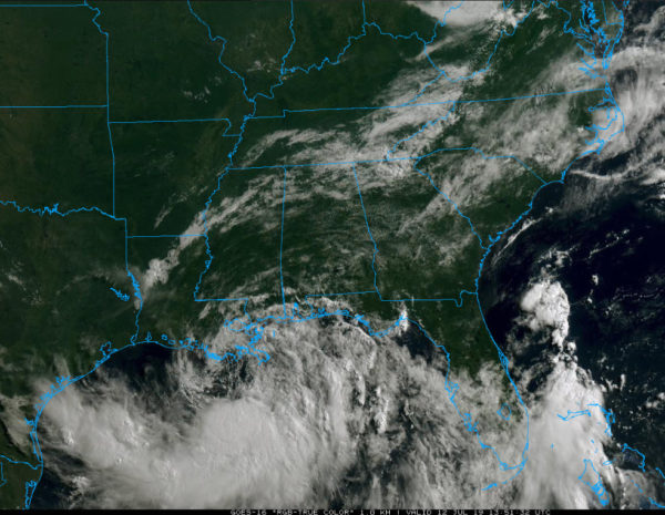
Tropical Storm Barry continues to slowly strengthen this morning and is showing signs of becoming better organized.
The system has been battling dry air, but now we see signs on coastal radars that its eastern side is moistening up. And deep convection appears to be forming on the southern edge of the center. If this convection can wrap around the center, significant strengthening will be able to occur.
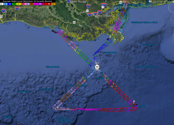
Air Force reconnaissance just found a minimum central pressure of 999 millibars in one of the swrils rotating around a larger center. BArry is in effect a large, multi-vortex tropical cyclone.
The mesoscale models all predict it will become a well-formed tropical cyclone before landfall tomorrow morning. They indicate it will be stronger than the global models, in the 980-985 millibar area. The WRF is an outlier, taking it to 960 millibars. Most of the mesoscale models place it in the category one hurricane range, 75-85 mph.
There are indications that it may continue to strengthen for a while after landfall. Southern Louisiana has a lot of water and has been called a “brown sea” meaning a tropical cyclone still can strengthen after moving ashore since there is still a lot of moisture to draw on.
The global models are weaker, keeping Barry in the 990-995 millibar range as a tropical storm.
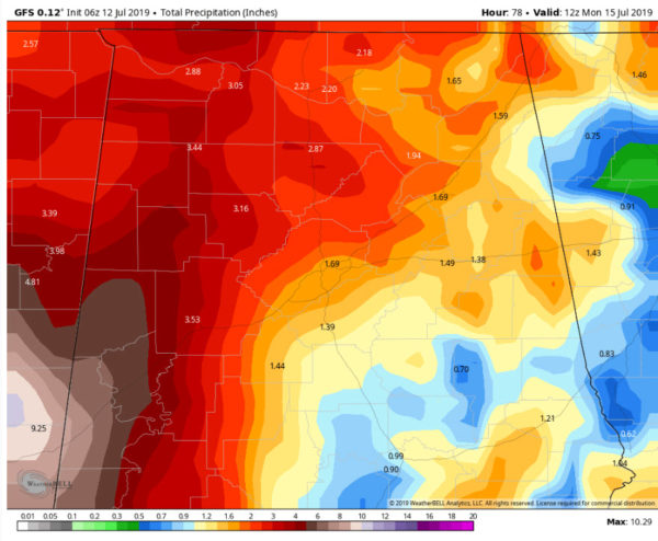
For Alabama, impacts will be fairly minimal. Areas west of I-65 may see 1-2 inches of rain between now and Monday with the border counties with Mississippi perhaps seeing 2-4 inches. Most of the rain will fall Sunday, with a round of scattered showers expected today, another couple of rounds tomorrow, and some heavier rain bands near the Mississippi border on Sunday.
The tornado threat appears to be minimal, although Sunday will be the time to watch, especially over western sections.
Winds will pick up on Sunday over western counties, averaging 15-20 mph during the day.
Category: Tropical


