A Quick Check On The Severe Storm Potential Just Before 11:00 AM
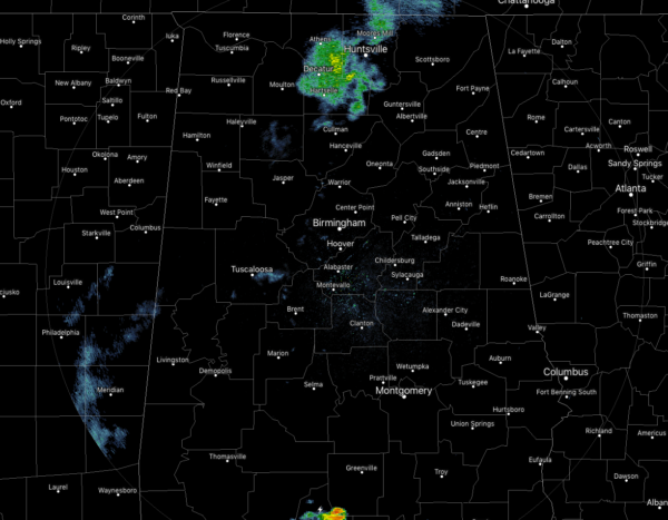
At 10:50 am, the radar is pretty quiet across Central Alabama, but we do have a few showers moving across the central portions of North Alabama. We currently have mostly cloudy skies across much of the area which may limit storm development for a little bit, but those are expected to form during the next few hours.
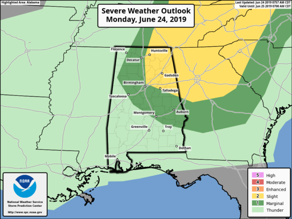
There is a risk for severe weather across parts of Central Alabama through 7:00 pm tonight. The threats will be damaging winds up to 60 mph and quarter size hail. A Slight Risk for severe storms is up for locations east and north of a line from Madison to Tarrant to Ashland to Roanoke. A Marginal Risk is up for locations west and south of that to a line from Muscle Shoals to Hamilton to Coker to Autaugaville to Eufaula.
An outflow boundary from an MCS pushed onto the western parts of the area this morning, and this may be the focusing point for where we can see convective development later this morning and through the afternoon hours. Instability values are already in the 2,500-3,500 J/kg range. Along with that, we’ll also have a shortwave move through the area that will provide some larger scale lift.
Needless to say, just as with the previous few days, we’ll have to watch any storms that develop as the potential will be there for strong to severe storms. Strong winds, heavy rain, some hail, and dangerous cloud-to-ground lightning will be possible. The main window for stronger to severe storms will go through 7:00 pm this evening. We’ll keep you posted throughout the day.
Category: Alabama's Weather, ALL POSTS, Severe Weather


