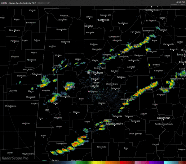
A Quick Radar Check Just Before 5:30 PM, Marginal Risk Continues
At 5:22 pm, we continue to have scattered showers and a few rumbles of thunder moving across Central Alabama. All of these showers are moving to the east at 20 MPH. While most are producing light to moderate rainfall, some are producing brief periods of heavy downpours. The good news is that with the smaller size of these cells, the rain is not lasting all that long to create any flash flooding issues.
We still continue to have a Marginal Risk for severe storms across much of Central Alabama, but it is looking more unlikely as we continue to move through the early evening hours. Threats continue to be isolated damaging wind gusts up to 60 MPH and some hail up to dime size.
The latest run of the HRRR shows the scattered activity will move out during the overnight hours as there is still potential for a few more showers to develop and move across the area.
The cold front is currently bisecting the state from northeast to southwest roughly from Scottsboro to Birmingham to Linden. West of the front, the severe threat is over but a few showers will remain possible. East of the front, we still have a couple of hours before we can let our guard down.
We still have plenty of instability in place over Central Alabama with CAPE values up in the 1,000-1,500 J/kg range, so there is still a possibility of more development along with the energy for the current cells to last for a while.
Category: Alabama's Weather, ALL POSTS, Severe Weather


