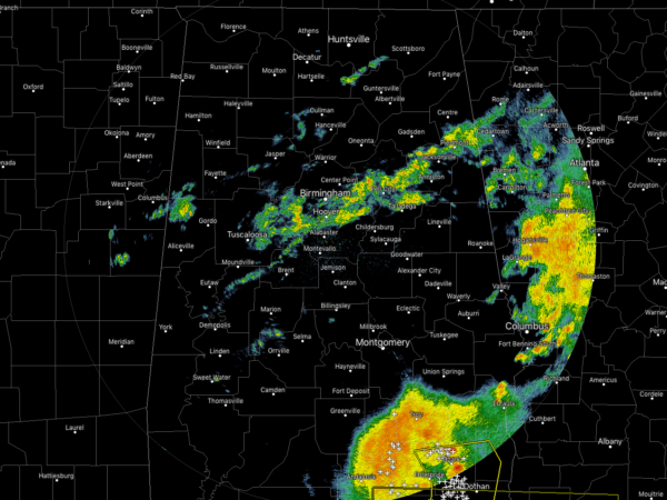
Radar Check At 10:30 AM, Quieting Down Across The Area For Now
Radar continues to show moderate to heavy rainfall over the extreme southeastern pars of Central Alabama, mainly over Pike and Barbour counties. A severe thunderstorm warning is in effect for parts of Coffee, Geneva, Houston, Dale and Henry counties in South Alabama until 10:45 am for the threat of damaging winds up to 60 MPH. This cell will stay south of Pike and Barbour counties and should be moving into Georgia within the next 30-60 minutes.
We have another broken line of lighter to moderate showers moving eastward over the I-20 corridor in the central parts of Central Alabama. No lightning occurring with these, just plain ole rainfall.
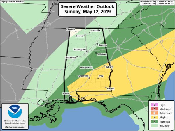
SPC continues a Slight Risk of severe storms for locations roughly along and south of the I-85 corridor in the southeastern parts of Central Alabama while a Marginal Risk stretches from there northward to just south of the I-59 corridor. Main threats will be from damaging winds up to 60 MPH and quarter size hail. Tornado threat is very, very low but not zero.
Instability has already started to climb over the area as we are seeing CAPE readings in the 500-1,000 J/kg range. With the front starting to move through the area during the afternoon hours, it will provide the lift for the development of more showers and thunderstorms. Limiting factor for development at this point over the northern parts of the area is that dewpoints are only in the lower 60s while dewpoints in the upper 60s to lower 70s persists south of the I-20 corridor. Some of that moisture may work northward before the front pushes through the area, but the most unstable air is expected to be in the severe risk areas.
There may be more showers and thunderstorms develop over the northern parts of the area, but the chances of those are less than what is possible for the southern and southeastern parts of the area. Once the front moves through, we will dry out behind the front and we will stay dry until late on Wednesday. It will be a refreshing day on Monday with highs in the mid to upper 70s after starting off with morning lows in the lower 50s to the lower 60s.
Category: Alabama's Weather, ALL POSTS


