SPC Upgrades To Slight Risk For Western Parts Of Central Alabama
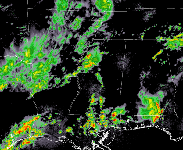
As of 11:30 am, we have a few scattered showers in the northwestern parts of Central Alabama and up into the western parts of North Alabama, but now the main focus has shifted to the southern parts of Central Alabama as we have a stronger thunderstorm affecting parts of Pike County. Winds up to 40 MPH are possible with this cell and is moving to the northeast at 40 MPH. No watches or warnings are in effect for Central Alabama at this point.
A shortwave is currently moving through which is providing the lift needed for the development of showers and thunderstorms. That activity is currently located over the northwestern parts of Mississippi and back into Arkansas and northern Louisiana, and back into northeastern Texas.
We have an environment in place that is expected to continue to destabilize during the late morning and through the afternoon hours with the main heating of the day, especially with the breaks in cloud cover over the area.
We could see activity move into the western portions of Central Alabama as early as 2:00 pm. With the upper-level support, we have in place with the stalled front, strong to severe thunderstorms will be possible with the threats being damaging straight-line winds up to 60 MPH and hail up to quarter-size.
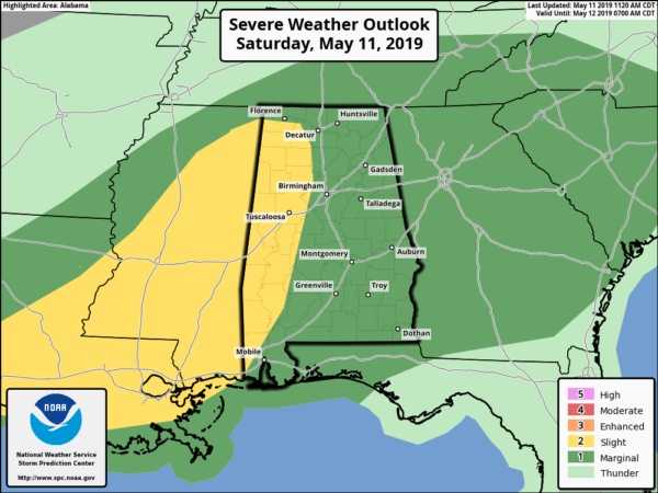
The Storm Prediction Center has just released an update to the severe weather outlook and now the western-third of the area is now under a Slight Risk of severe storms while the rest of the area is under a Marginal Risk. The main window for severe storms will be from 2:00 pm to around 10:00 pm tonight.
Category: Alabama's Weather, ALL POSTS, Severe Weather


