A Quick Update At 10:00 AM, Severe Potential Continues
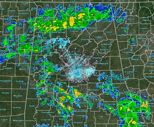
While the weather has settled down some from earlier this morning, we continue to have showers and thunderstorms across a good portion of North/Central Alabama. The stronger cells at this point are located over Dallas, Perry, and Autauga counties with heavy rainfall and several cloud-to-ground lightning strikes. They are moving to the north-northeast at roughly 30 MPH. All of the rest of the activity is light to moderate rainfall at this point.
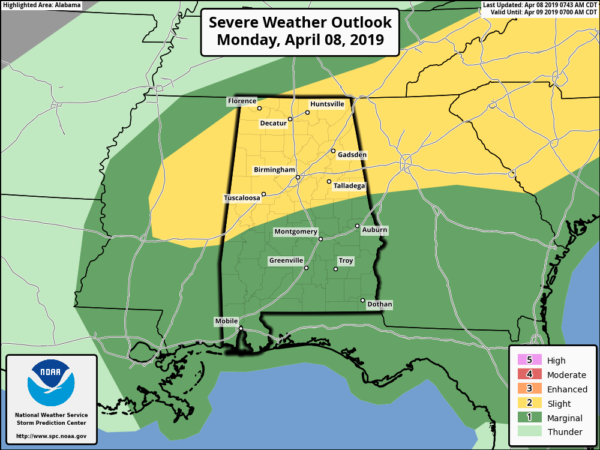
We continue to have a Slight Risk for severe storms for nearly all of North Alabama and much of Central Alabama, with a Marginal Risk for locations in the southern parts of Central Alabama.
All modes of severe weather are the threats for today… tornadoes, damaging winds up to and exceeding 60 MPH, and large hail.
The window for stronger to severe storms will be from now until 9:00 pm tonight for the western-third of the area, and from 11:00 am to 7:00 pm for the central and eastern parts.
Things will become more active as we get more into the heating of the day. There will be plenty of instability later this morning and into the afternoon hours. Storms will develop and will be scattered to numerous in nature with the potential for the development of supercells, some of which could rotate and possibly drop a tornado or two.
Today is a day we do not need to let our guard down. Be ready just in case your location goes under a warning. We also need to expect the unexpected as this is the prime of our Spring Severe Weather Season. We’ll keep you posted on the blog throughout the day.
Category: Alabama's Weather, ALL POSTS, Severe Weather


