Severe Threat Continuing To Wind Down In Central Alabama
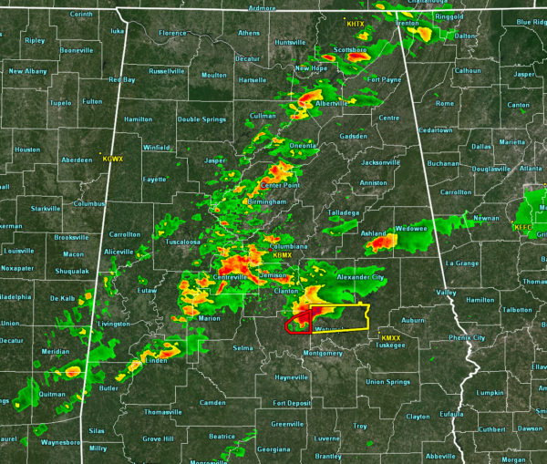
At 9:20 pm, the thunderstorm activity continues to weaken across North/Central Alabama as we only have one active warning… a Severe Thunderstorm Warning for northern parts of Elmore County until 10:30 pm tonight. A Tornado Warning continues for just a few minutes more for northeastern Autauga County, but that will be allowed to expire as NWS Birmingham believes that the rotation has become broad. With that being said, don’t let your guard down, Elmore County.
The rest of the shower and thunderstorm activity is under severe limits, but lightning output is still impressive in the heavier cells along and ahead of the line.
Instability continues to fall as we have lost the daytime heating, plus rain has helped to cool and stabilize the airmass west of I-59. Helicity values continue to drop as well, now down into the 250-400 m2/s2 range. Unfortunately, that is still supportive of rotating updrafts. Nearly all of Central Alabama now has STP values around 1.0.
While the threat of a few severe storms remain possible east of I-59, enough of the dynamics have moved out of the area to allow for those risks to drop somewhat. Once the big thunderstorm cell in Clay and Randolph counties make it out of the state, NWS Birmingham may start trimming counties from the Tornado Watch.
At this point, a Tornado Watch continues until midnight for Autauga, Chilton, Clay, Coosa, Dallas, Elmore, Lowndes, Randolph, Talladega, and Tallapoosa counties.
We’ll keep you posted throughout the night until the severe threat ends.
Category: Alabama's Weather, ALL POSTS, Severe Weather


