Strong To Severe Storms Moving Through Now, Another Batch To Come In A Few Hours
Collaborative post by Bill Murray and Scott Martin.
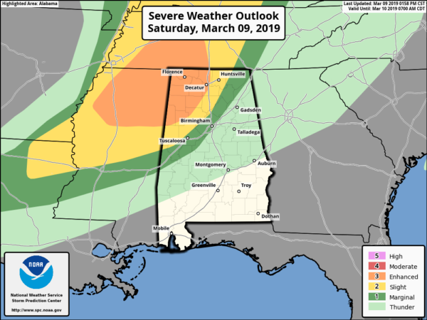
SPC continues an Enhanced Risk of severe storms for locations west of a line from Millport to just west of Jasper to Hartselle to Ardmore. A Slight Risk continues for locations east of that to a line stretching from Geiger to Warrior to Hytop. A Marginal Risk continues for locations east of that to a line stretching from Cuba to Brent to Ider.
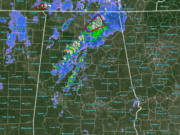
The initial line of storms now extends from east of Huntsville and Decatur to west of Jasper back into northern Tuscaloosa and Pickens Counties. A tornado warning was just issued for Jackson, Madison, Marshall and Morgan Counties in North Alabama for the storm passing north of Morgan City. Further south, the storms have remained below severe levels and don’t pose a significant threat for now. We will be watching them closely.
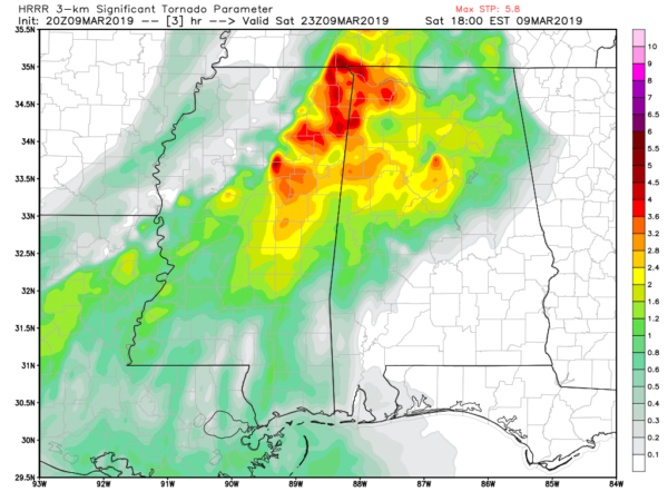
Models continue to show a destabilizing atmosphere throughout the remainder of the afternoon over the north and northwestern parts of the state, mainly west of the I-59 corridor. The latest HRRR is showing instability values maxing out close to 2,000 J/kg over the risk locations at around 5:00 pm. Helicity will be around 400 m2s2, which is plenty to support rotating updrafts and supercell development. Significant Tornado Parameter values will be topping out at 5.5 in the same region as well.
This is confirming the concern that NWS Birmingham just mentioned in our chat about the intensifying cores now in Mississippi. A lull is occurring behind this first batch of storms and the 2nd batch. Instability is rebuilding behind the 1st batch and allowing for the 2nd batch to intensify quickly. These will arrive in the western parts of the area within the next couple of hours.
We want our friends in Northwestern Alabama to monitor the situation very closely later this afternoon and this evening. The main threat appears that it will come between 4:30 – 9:30 p.m. for areas northwest of I-59, and mainly for Lamar, Fayette, Marion, Walker, Cullman, Marshall and Jackson Counties north into southern Tennessee. Be ready to leave manufactured homes in plenty of time to reach a substantial structure before the storms reach you. Waiting for the tornado warning could be too late. Review our safety tips now and have multiple ways to receive warnings. Stay with us here on the AlabamaWX blog and we will keep you fully informed with frequent updates.
The line should weaken as it drifts south into the Birmingham and Tuscaloosa areas between 9 p.m. and midnight. But the line of storms will still have a threat of damaging winds and a couple of isolated tornadoes.
Category: Alabama's Weather, ALL POSTS, Severe Weather


