Tornado & Damaging Wind Threat Continues At 1:30 PM
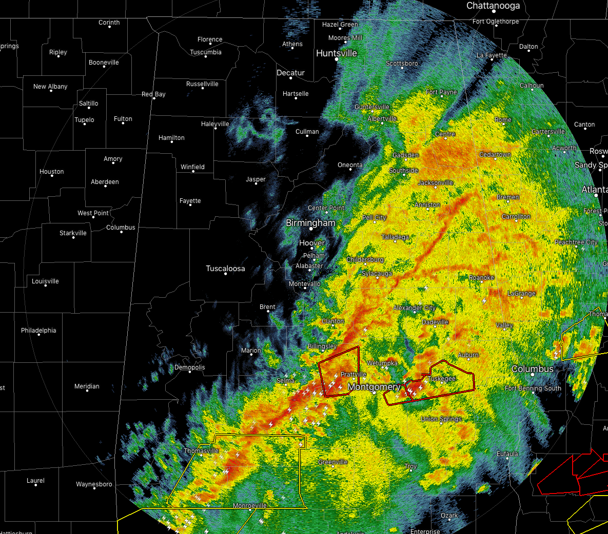
The focus continues to be on the southern portions of Central Alabama as the action really has picked up over the past hour. Three Tornado Warnings are currently in effect for cells that are displaying decent rotation couplets. The warning for parts of Montgomery should be canceled within the next few minutes as the cell is crossing over into Macon County. The rotation on the cell in Autauga County is starting to become a little less impressive, but enough to keep the warning going.
The threat for tornadoes and damaging winds continue over the locations in the tornado watch as the southern end of the activity has now transitioned into more of a squall line configuration. There are supercellular structures within the line which means damaging winds and a quick tornado are possible at any time.
For the rest of Central Alabama, the rain has pretty much ended for locations north of the I-59 corridor with the exception of the northeast corner of the area. Temperatures will begin to drop and much colder and drier air begins to move in.
We’ll keep you posted throughout the afternoon.
Category: Alabama's Weather, ALL POSTS, Severe Weather
About the Author (Author Profile)
Scott Martin is an operational meteorologist, professional graphic artist, musician, husband, and father. Not only is Scott a member of the National Weather Association, but he is also the Central Alabama Chapter of the NWA president. Scott is also the co-founder of Racecast Weather, which provides forecasts for many racing series across the USA. He also supplies forecasts for the BassMaster Elite Series events including the BassMaster Classic.Subscribe
If you enjoyed this article, subscribe to receive more just like it.


