Potential For Strong Tornadoes & Damaging Winds Increasing, Tornado Watch Issued
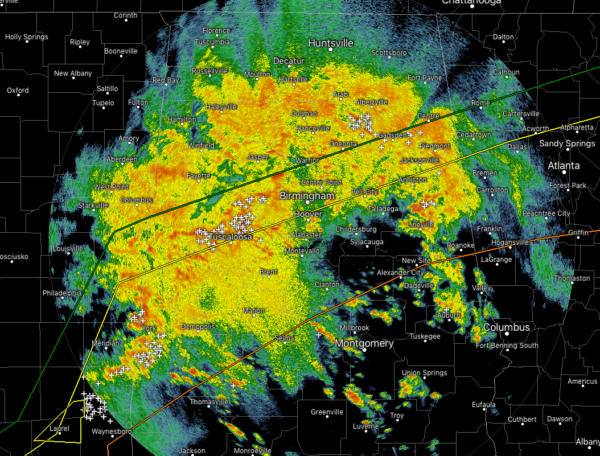
At the 11:00 am hour across Central Alabama, a large mass of rain and thunderstorms cover nearly the entire area with the exception of the southeastern parts of the area. There have been some changes to the forecast as the system now will be moving through the area much quicker than expected, but will also become more cellular in nature later today.
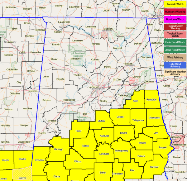
A Tornado Watch was just issued for the southern parts of Central Alabama and down into south and southwest Alabama, northwest Florida, southeastern Mississippi, and eastern Louisiana until 6:00 pm tonight. The counties in Central Alabama include Autauga, Barbour, Bullock, Chambers, Chilton, Clay, Coosa, Dallas, Elmore, Lee, Lowndes, Macon, Marengo, Montgomery, Perry, Pike, Randolph, Russell, and Tallapoosa.
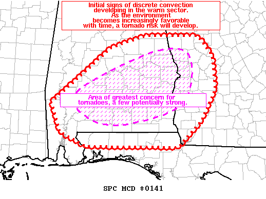
The latest from NWS Birmingham states that the threats for a strong tornado or two are possible in the Enhanced Risk locations of Central Alabama. The line of storms has the potential to become more supercellular in nature which would lead to an increased risk of tornadoes. Areas in the pink hatched areas of the above map are where the greatest strong tornado concern is.
The warm front has actually made it farther north than expected, so that increases the risk for severe storms farther north, maybe as far north as the I-20 corridor now.
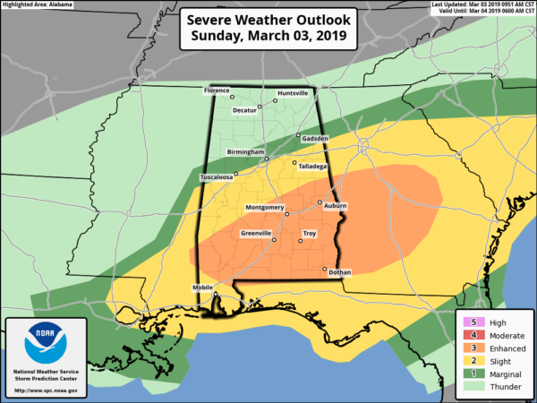
There will be no change to the risk map as of now. An Enhanced Risk (level 3 of 5) continues for locations south of a line stretching from Sweet Water to Billingsley to Daviston. A Slight Risk (level 2 of 5) continues for areas north of the enhanced risk to a line stretching from Tuscaloosa to Vestavia Hills to Saks.
We’ll continue to keep you posted throughout the day.
Category: Alabama's Weather, ALL POSTS, Severe Weather


