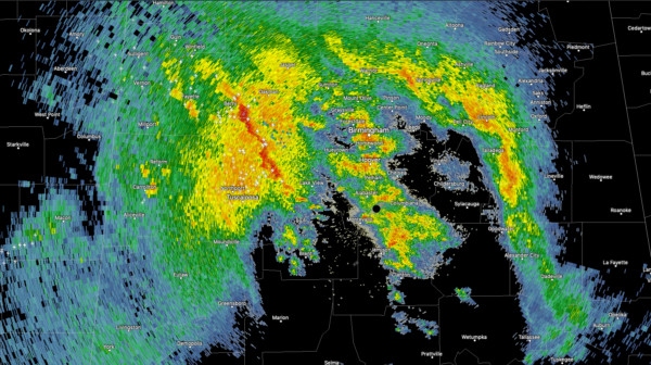
Thunderstorms Moving Across Fayette, Walker and Tuscaloosa Counties, Will Affect Jefferson County Next
Thunderstorms extend from Berry in Fayette County down to just northeast of Tuscaloosa at this hour.
There are not severe and lightning and brief heavy rain will be their main threats. They are elevated, meaning their instability source is elevated, or aloft, not rooted in the surface layer. This means the thunder will be impressive, as the lightning travels over a longer channel, making for long, booming thunderclaps.
The weak surface low is now centered just west of Meridian, MS. AS it lifts northeast, storms will be strong to severe to its south, over southern Alabama.
Dewpoints are in the lower and middle 60s across far southern Alabama. These juicy dewpoints will lift as far north as the I-85 corridor Storms just southeast of Jackson MS will become strong to severe as we head into the early afternoon hours. A couple of strong tornadoes are possible south of a line from Chatom to Selma to Alex City. Damaging winds will be the threat otherwise.
Category: Alabama's Weather, ALL POSTS, Severe Weather


