Flood Watches Issued Ahead Of This Week’s Flooding Potential
Flood Watch in effect from Tuesday through late Thursday night.
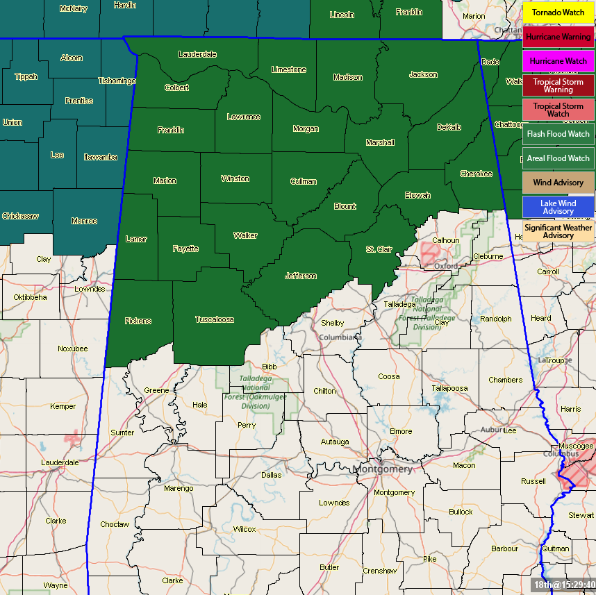
NWS Birmingham and NWS Huntsville have issued an Areal Flood Watch for all of North Alabama and the northern parts of Central Alabama until 6:00 am Saturday morning.
NWS Huntsville counties in the watch: Colbert, Cullman, DeKalb, Franklin, Jackson, Lauderdale, Lawrence, Limestone, Madison, Marshall, Morgan.
NWS Birmingham counties in the watch: Blount, Cherokee, Etowah, Fayette, Jefferson, Lamar, Marion, Pickens, St. Clair, Tuscaloosa, Walker, Winston.
Multiple rounds of heavy rainfall are expected starting Tuesday and continuing through the end of the week for portions of North and Central Alabama. Surface soil conditions are already or will become saturated, and much of this rainfall will runoff, filling low lying areas, ditches, and creeks. Local rivers and streams are also expected to rise due to excessive rainfall locally and across upstream river basins.
Those with interests in flood prone or low lying areas, and along local rivers in north and West-Central Alabama, should be ready to take action if water levels rise.
A flood watch means there is a potential for flooding based on current forecasts. You should monitor later forecasts and be alert for possible flood warnings. Those living in areas prone to flooding should be prepared to take action should flooding develop.
Category: Alabama's Weather, ALL POSTS
About the Author (Author Profile)
Scott Martin is an operational meteorologist, professional graphic artist, musician, husband, and father. Not only is Scott a member of the National Weather Association, but he is also the Central Alabama Chapter of the NWA president. Scott is also the co-founder of Racecast Weather, which provides forecasts for many racing series across the USA. He also supplies forecasts for the BassMaster Elite Series events including the BassMaster Classic.Subscribe
If you enjoyed this article, subscribe to receive more just like it.


