Very Nice Temperatures Across Central Alabama At Midday; Rain Returns Late Tonight
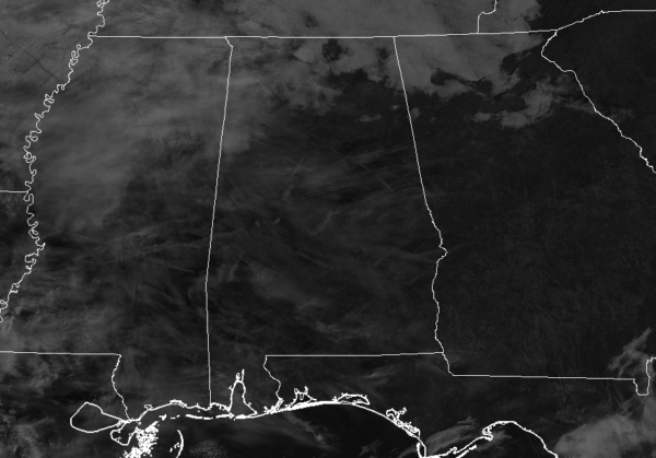
As of 11:30 am on this fine final Wednesday of 2018, we have some thin clouds filtering out the sun across portions of the area while cloud cover is starting to become a little thicker over the northern and northwestern parts of the state. We are dry, but that will be a completely different story in just 24 hours. Temperatures at this point are in the upper 50s to the mid-60s, with Birmingham currently at 61 degrees. The warm spot is Uniontown at 64 degrees while the cool spots are Pell City and Gadsden at 57 degrees.
While we have some high and thin clouds across much of the area at this point, we’ll continue to have more thicker clouds move in during the rest of the afternoon and into the early evening hours. We stay dry for now and afternoon highs will top out in the upper 50s to the mid-60s across the area from north to south. Clouds will continue to move in making us cloudy tonight with rain moving into the western portions of the area at or just around midnight. That rain will progress across the area and nearly all of the area will have rain falling at daybreak. Overnight lows will be in the mid-40s to the lower 50s.
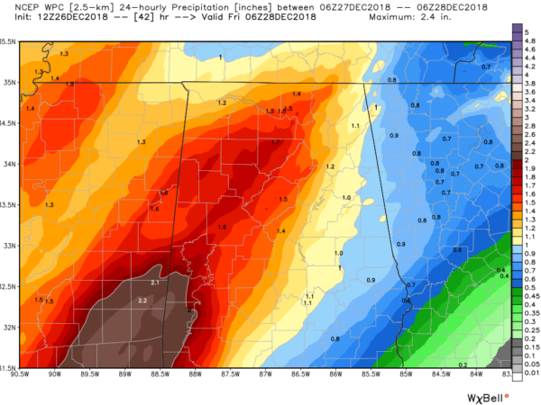
Thursday will be a wet day across the area as rain will fall throughout much, if not the entire day. The WPC is forecasting 0.75 to 1.75 inches across the area from 12:00 am Thursday to 12:00 am Friday. While severe weather is possible to our west, instability will be elevated and severe weather is not expected. There will be some thunder at times and afternoon highs will be in the upper 50s to the mid-60s.
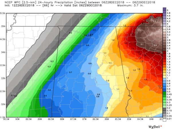
While more rain will be likely throughout the first half of Friday, we could have it coming to an end for a little while from west to east starting in the afternoon hours. Even with that being said, totals are forecast to be around 0.50-1.00 inches across the area for the day. We may get some clearing behind this part of the system with mostly clear skies for much of the area by the late evening. Afternoon highs will be in the lower 60s to the lower 70s across the area.
Beach Forecast Center: Get the latest weather and rip current forecasts for the beaches from Fort Morgan to Panama City on our Beach Forecast Center page. There, you can select the forecast of the region that you are interested in.
We’re Having A Record-Breaking Year On The AlabamaWx Weather Blog… Advertise With Us Today!: Don’t miss out! We have enjoyed nearly 19.5 MILLION page views on AlabamaWx.com so far in 2018. We can customize a creative, flexible and affordable package that will suit your organization’s needs. Contact Bill Murray at (205) 687-0782.
E-Forecast: Get the Alabama Wx Weather Blog’s Seven-Day Forecast delivered directly to your inbox by email twice daily. It is the most detailed weather forecast available in Central Alabama. Subscribe here… It’s free!
Connect With The AlabamaWx Weather Blog On Social Media: You can find the AlabamaWx Weather Blog on the major social media networks:
Facebook
Twitter
WeatherBrains: Don’t forget you can listen to our weekly 90 minute netcast anytime on the web at WeatherBrains.com or on iTunes, Stitcher, or Spotify. This is the show all about weather featuring many familiar voices, including the meteorologists at ABC 33/40.
On This Day In Weather History: 1776 – George Washington crossed the ice-clogged Delaware River. He marched on Trenton in the midst of snow and sleet thus surprising and capturing many of the British garrisons.
Category: Alabama's Weather, ALL POSTS


