Still Relatively Quiet In North/Central Alabama, Storms Are Building To Our West
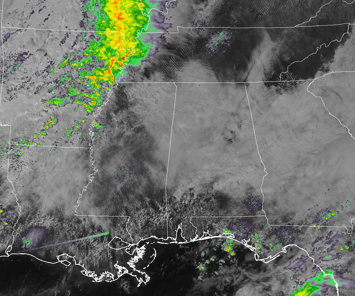
Storms are starting to reach the Mississippi River in the eastern parts of Arkansas and up into southern parts of Missouri, but everything remains relatively quiet to our west in Mississippi and down into Louisiana. So far, no mesoscale discussions or severe weather watches or warnings have been issued for this system throughout the morning and into the early afternoon hours. That will more likely change as we get later into the afternoon and early evening hours. Cloud cover is starting to erode away over parts of Alabama, but much of us are still blanketing by clouds.
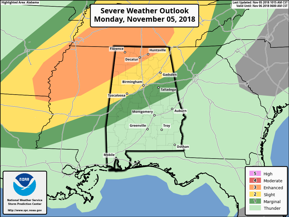
SPC SEVERE OUTLOOKS: An Enhanced Risk for severe storms continues for locations in North Alabama north of a line from just south of Sulligent (Lamar Co) to Falkville (Morgan Co.) to Stevenson (Jackson Co.). A Slight Risk continues for an area stretching as far south as Gainesville (Sumter Co.) to Vestavia Hills (Jefferson Co.) to Piedmont (Calhoun Co.). A Marginal Risk continues for an area that extends as far south as Needham (Choctaw Co.) to Billingsley (Autauga Co.) to Wadley (Randolph Co.).
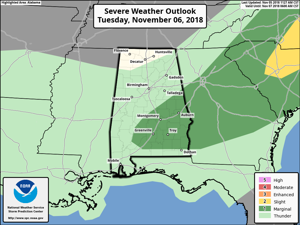
The Day 2 Outlook keeps a Marginal Risk for severe storms but has been adjusted to roughly the southeastern corner of Central Alabama through the morning hours on Tuesday. The Slight Risk has been removed from extreme eastern parts of the area.
Please remember… Just because you are not located in the Enhanced or Slight Risk does not mean you are in the clear. You can still have damaging winds and tornadoes, but the chance for these are lower. Still, keep your plan ready to go. If your location goes under a warning, know what to do.
TIMING: The main window for severe storms across North and Central Alabama continues to be from 9:00 PM tonight through 9:00 AM Tuesday morning. A squall line will be entering the state right around or before the midnight hour tonight that will bring the larger threat of damaging winds and maybe a couple brief spin-up tornadoes, but we’ll have the risk of supercells developing out ahead of the line that will have the larger threat of tornadoes. Some hail may be possible, but not likely with this event.
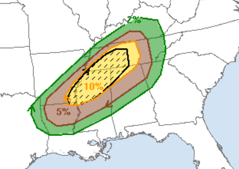
TORNADO PROBABILITY OUTLOOK: This graphic from the Storm Prediction Center shows the probability of tornadoes passing within 25 miles of any one point. The percentages may look low, but you have to remember that tornadoes are very tiny compared to the area defined in a probability. The 10% probability is actually a pretty high percentage. The hatched area in black means that a few strong tornadoes of EF2 or higher are possible.
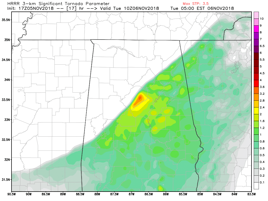
MODELS: The latest run of the HRRR continues to show instability values in the 1,000-1,800 J/kg range and storm relative helicity values in the 250-500 m2s-2 range. This means we have a good bit of instability and a very high amount of shear that will be supportive of damaging winds and rotating updrafts. Significant Tornado Parameter values are still running in the 2.0-3.0 range, but there are a few spots where it briefly hits 3.5 over the east-central parts of Jefferson County at 4:00 AM.
SCHOOL CLOSINGS: No school closings for this afternoon or tomorrow in the area has been announced. To see the latest information on school closing, please visit the ABC 33/40 Closings page on their website.
We’ll continue to have updates throughout the day on the blog.
Category: Alabama's Weather, ALL POSTS
About the Author (Author Profile)
Scott Martin is an operational meteorologist, professional graphic artist, musician, husband, and father. Not only is Scott a member of the National Weather Association, but he is also the Central Alabama Chapter of the NWA president. Scott is also the co-founder of Racecast Weather, which provides forecasts for many racing series across the USA. He also supplies forecasts for the BassMaster Elite Series events including the BassMaster Classic.Subscribe
If you enjoyed this article, subscribe to receive more just like it.


