Strong Storms Continue In The East, Rain Ending Quickly In The West
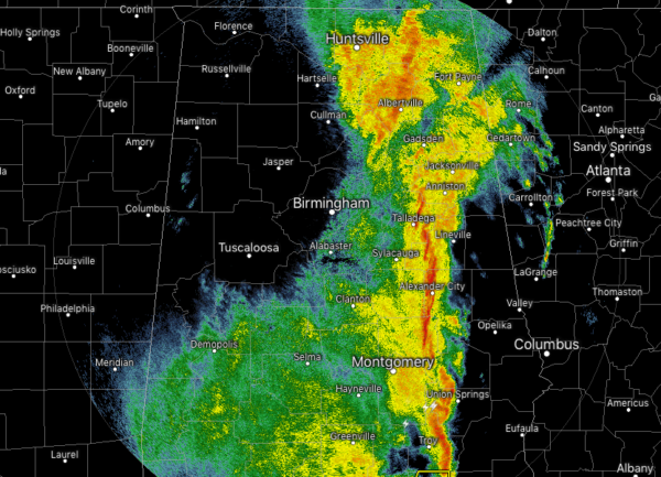
While we continue to have a line of stronger storms moving across the eastern portions of North/Central Alabama at 11:00 AM on this first day of November, rain is quickly coming to an end over the western parts of the area. The strongest part of the line stretches from Scottsboro to Talladega to Alexander City to Brundidge, where gusty winds up to 40 MPH and heavy rainfall is occurring. Behind those stronger storms, the rain quickly dissipates in strength and has completely stopped for Cullman, Birmingham, Tuscaloosa, and points west.
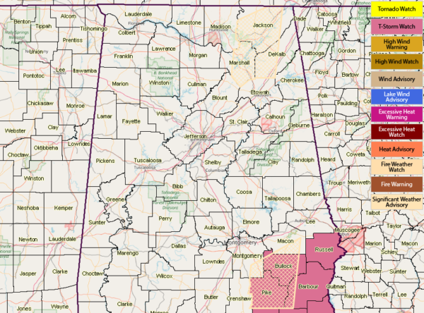
The Tornado Watch has now been completely cancelled in Central Alabama, but NWS Birmingham continues a Severe Thunderstorm Watch for Barbour, Bullock, Pike, and Russell counties in the southeastern parts of the area until 2:00 PM. The organized severe weather threat is over for locations west of the line of storms.
Other than a few trees being reported down in the northwestern corner of the state, there has been no major damage reports from today’s storms.
For the rest of today, that main line of storms will continue to push through the eastern parts of North/Central Alabama, with rain coming to an end quickly behind that. A few showers or thunderstorms may form along the cold front when it moves through a little later today, but those shouldn’t last all that long if they do form. Afternoon highs should top out in the upper 60s to the upper 70s. A few isolated to scattered showers may linger throughout the late night and overnight hours, but much of those should be out of the area before sunrise on Friday. Lows will get down into the upper 40s to the lower 60s from northwest to southeast.
Once we get those lingering showers out of here early on Friday morning, the rest of the day will be mainly cloudy with highs in the mid-50s to the lower 60s from northwest to southeast. Skies will begin to clear in the west during the early evening hours and eventually work its way eastward by the late night hours. Temperatures at the start of the local high school football games will be in the upper 40s to the mid-50s, and falling into the mid-40s to the lower 50s by the final whistle. We may have some fog developing in the valleys and near bodies of water during the late night and overnight hours, and lows will fall into the upper 30s to the lower 40s.
Category: Alabama's Weather, ALL POSTS


