Detailed Look at Impacts for Central Alabama: Just Some Gusty Winds For Most, Rain for Some; Widespread 40s Friday Morning!
Most of Central Alabama is feeling Hurricane Michael this morning, in the form of northeasterly winds averaging 5-10 mph. Skies are cloudy for the most part.
RAINFALL
Rain has reached as far north as Selma in Dallas County over to Montgomery and Alex City. Moderate to heavy rain now covers all of South Alabama generally east of I-65 and south of I-85.
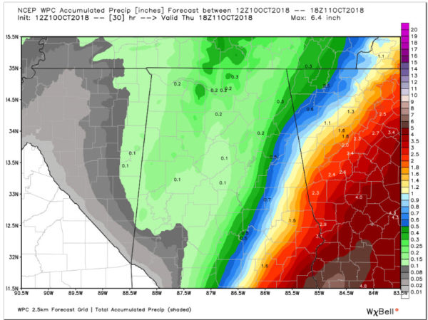
Rain will continue to increase in coverage and intensity through the rest of the morning and into the afternoon. Eventually, rain should be steady for areas east of a line from Centre to Ashville to Selma to Evergreen through the afternoon. The rain will begin to move east between 3-6 p.m., and will exit East Alabama by midnight.
To the west, you can see showers lined up over western Mississippi ahead of our approaching trough. These showers will move across West Alabama in the wake of the storm this evening. This will be the bulk of the rain that areas west f I-65 sees.
Rainfall amounts will not be impressive:
WIND
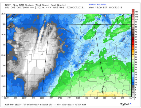
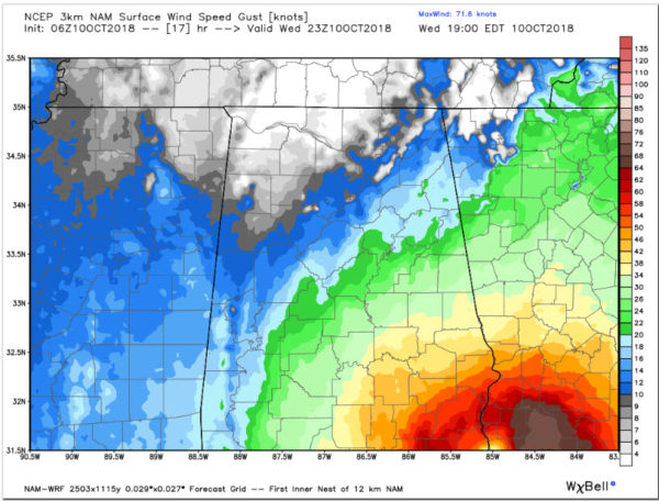
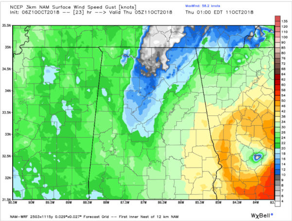
I will let the maps tell the story. Shades of blue are 10-20 knots (12-23 mph), green 20-33 knots (23-38 mph), yellow is tropical storm force of 34 knots (39 mph) or greater.
Here are forecasted wind gusts at noon.
And at 6 p.m. Look at the strong tropical storm force winds over Southeast Alabama.
By midnight, tropical storm force gusts may be felt from Cleburne County down through the eastern counties of Alabama.
You can see the center of what will still be Hurricane Michael moving through southern Georgia. There will be massive power outages and wind damage across the state of Georgia.
DRIER AIR AHEAD
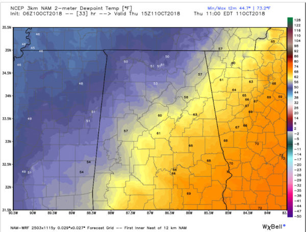
Much drier air will begin to overspread Alabama during the morning hours as a cold front pushes across the state in the wake of Hurricane Michael.
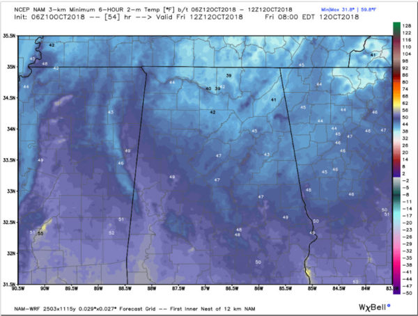
Lows by Friday morning will be in the 40s in many locations, with some 30s in the colder locatoins of North Alabama!
It will be a beautiful weekend!
Category: Alabama's Weather, ALL POSTS


