At Midday, Warming Up In Central Alabama & All Eyes On The Gulf
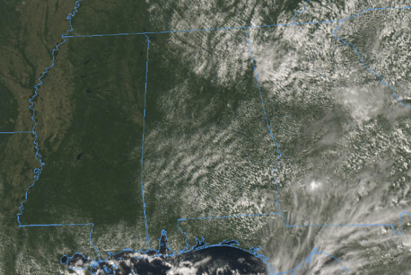
Conditions at 11:10 AM across Central Alabama has a good bit of sunshine reaching the surface with some cumulus clouds floating overhead filtering some of that sun at times. Unfortunately, temperatures are not being held back by those clouds as we are seeing reports coming in in the 81-86 degree range throughout the area. Birmingham was sitting at 81 degrees. The warm spot was Eufaula at 86 degrees.
We see throughout the remainder of the afternoon hours that we have a small risk of a few isolated to scattered showers and maybe a thunderstorm across Central Alabama. Rain chances will be higher in the southeast corner of the area (south of I-85 and east of I-65), around 30-40%, while chances for the rest of the area will be 20% and less as you move north from there. Afternoon highs will top out in the upper 80s to the lower 90s throughout the area, but the good news is that this should be the last day we see 90 degree temperatures until the late spring of 2019. Rain chances will quickly diminish after sunset and we’ll be left with mostly clear to partly cloudy skies. Lows will be in the mid-60s to the lower 70s.
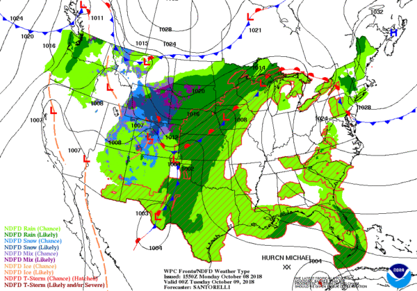
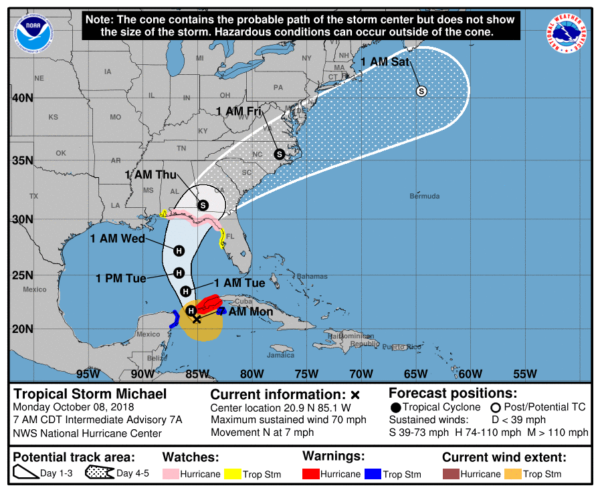
The latest on Hurricane Michael has maximum sustained winds at 75 MPH and movement is to the north at 7 MPH. The minimum central pressure is at 982mb, and the center was located in between Cozumel, Mexico and the western tip of Cuba.
Michael is now forecast to become a major hurricane (Category 3) as it nears the Florida coastline on Wednesday. Impacts to Central Alabama are currently expected to be smallmainly affect locations along and southeast of the I-85 corridor on Wednesday into early Thursday. Any shift to the west in the forecast track to cause a significant increase in the impacts to parts of Central Alabama on Wednesday and into the early parts of Thursday. As of now, 1-3 inches of rainfall can be seen from Michael over the southeastern locations in the area, and wind gusts of 25-35 MPH can be expected.
Once we get Michael out of the area, we’ll have much cooler conditions throughout the area. We’ll se highs in the lower 70s to near 80 degrees on Friday, and the upper 60s to the upper 70s for the weekend. You can expect excellent weather for the races at Talladega and for the local football games.
BEACH FORECAST CENTER
Get the latest weather and rip current forecasts for the beaches from Fort Morgan to Panama City on our Beach Forecast Center page. There, you can select the forecast of the region that you are interested in.
CONNECT ON SOCIAL MEDIA
You can find the AlabamaWx Weather Blog on the major social media networks:
Facebook
Twitter
WE’RE HAVING A RECORD-BREAKING YEAR… ADVERTISE WITH US TODAY!
Don’t miss out! We have enjoyed over 15.4 million page views on AlabamaWx.com since the start of 2018. We can customize a creative, flexible and affordable package that will suit your organization’s needs. Contact Bill Murray at (205) 687-0782.
E-FORECAST
Get the Alabama Wx Weather Blog’s Seven-Day Forecast delivered directly to your inbox by email twice daily. It is the most detailed weather forecast available in Central Alabama. Subscribe here… It’s free!
WEATHERBRAINS:
Don’t forget you can listen to our weekly 90 minute netcast anytime on the web at WeatherBrains.com or on iTunes, Stitcher, or Spotify. This is the show all about weather featuring many familiar voices, including the meteorologists at ABC 33/40.
ON THIS DAY IN WEATHER HISTORY
1871 – Prolonged drought and dessicating winds led to the great Chicago fire, the Peshtigo horror, and the Michigan fire holocaust. Fire destroyed more than seventeen thousand buildings killing more than 200 persons in the city of Chicago, while a fire consumed the town of Peshtigo WI killing more than 1100 persons. In Wisconsin, a million acres of land were burned, and in Michigan, 2.5 million acres were burned killing 200 persons. “Tornadoes of fire” generated by intense heat caused houses to explode in fire, and burned to death scores of persons seeking refuge in open fields.
Category: Alabama's Weather, ALL POSTS


