Hot Throughout The Weekend; Plus, Eyes On The Tropics
Summertime refuses to leave for this weekend as we continue to see heat values normal for late August and not early October, and could we have some tropical mischief affecting our weather next week? We’ll talk about that in a couple of minutes.
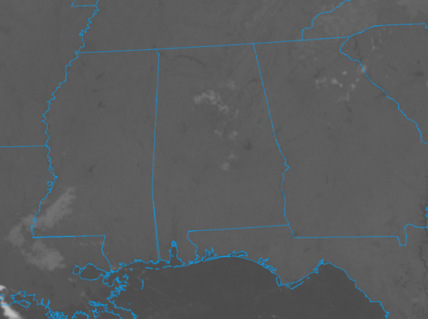
Skies are starting off mainly clear throughout the southeastern US at 6:00 AM, with only a few clouds floating overhead in Central Alabama. Temperatures are relatively mild at this point, with mid-60s to the lower 70s across the state. Birmingham was at 72 degrees, while the cool spots were both Fort Payne and Gadsden at 64 degrees.
On the watch/warning map, flash flood watches and warnings in effect for parts of Iowa and Illinois, and a dense fog advisory for parts of the Virginias. But we also see Old Man Winter trying to move in already as we have freeze warnings in effect for parts of Nebraska and a winter storm watch for eastern Wyoming and creeping into southeastern South Dakota.
As far as severe weather is concerned for today, there are two areas defined in the marginal risk for severe storms today as a few strong to severe thunderstorms may impact parts of the southern plains and the Ohio Valley later today and into the evening.
TODAY’S WEATHER
We have a cold front stretching across the central parts of the country from the Great Lakes down into Central Oklahoma and Northern Texas on the leading edge of a trough over the western US, but the ridge holds in the east, and that will continue to keep us hot throughout the day today with partly to mostly clear skies with a very slight chance of an isolated shower or two in the northeastern quarter of the state. Highs will be in the upper 80s tot he lower 90s throughout Central Alabama. Skies will be mostly clear throughout the overnight hours with lows dipping into the mid and upper 60s.
SUNDAY
Sunday’s weather will be a near repeat of today’s weather as the trough deepens in the west while the ridge continues to hold in the east. That means more hot temperatures with partly to mostly clear skies and just a very slight chance of a few isolated showers for the northern parts of the area. Highs remain in the upper 80s to the lower 90s. Sunday evening will be fair with lows in the upper 60s to the lower 70s.
NEXT WEEK
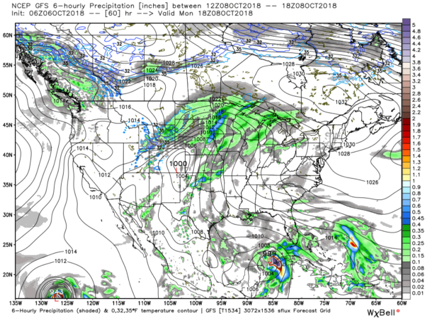
The start of next week shows that trough continue to deepen in the west, but the high pressure lift to the northeastward some, and this could lead to just a few more isolated to scattered showers across the area. Highs will be in the upper 80s to the lower 90s. But to the south just to the east of the Yucatan Peninsula. We are starting to see a tropical disturbance make the transition into the southern Gulf of Mexico. That could become a player in the forecast.
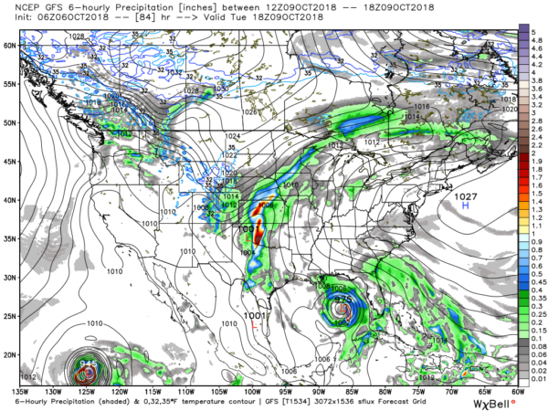
On Tuesday, the leading edge of the trough finally starts to edge towards the east forcing the ridge more off to the east, but we’ll continue to have a slight chance of a few isolated showers, mainly over the southern half of the area. Highs will be backing off somewhat, staying in the 80s. We see Invest 91L, which now looks to be Tropical Storm Michael, approaching the Central Gulf of Mexico, but it is still too early in the game for forecast strength and movement of this point. This is just one GFS model run.
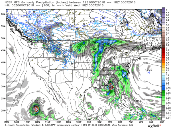
Wednesday, a cold front moving into the eastern parts of the country along with our tropical system moving onshore over the big bend area of the Florida panhandle. This will bring an increase to shower and thunderstorm coverage to the area. Highs will be in the lower to mid-80s.
The cold front will be knocking on our door just to our west on Thursday, forcing the movement of the tropical system on up into the Virginias and North Carolina, where they do not need anymore rain for a while. On this run, we’ll be well on the dry side, showing mainly dry conditions. But at this point, we just do not know where and if this tropical system will affect the southeast in this manner. For now we’ll go with a chance of scattered showers and storms, with highs in the upper 70s to the mid-80s.
Friday looks to be an outstanding day across Central Alabama with plenty of sunshine and highs in the upper 70s to the lower 80s.
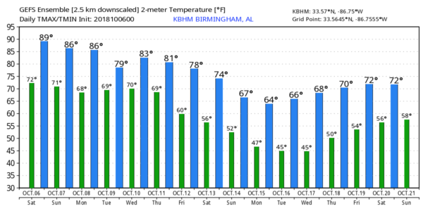
Just taking a brief step into Voodoo Land at the model trends on high and low temperatures for Birmingham throughout the next 16 days, we see that summertime will finally pack its bags and leave us until 2019 as highs will finally dip down into the 60s and 70s, with lows in the 40s and 50s.
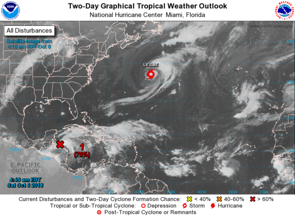
Taking a look at the tropics, we see Tropical Storm Leslie out there over the open Atlantic. She is no threat to land and is expected to accelerate in forward speed off to the east staying away from the US.
The story for us is the disturbance down just south of the Yucatan Peninsula that is now given a 90% chance of developing into a depression or storm within the next 5 days. Now known as Invest 91L, but will become Michael if it becomes more organized and forms into a tropical storm. Looking at model data shows that it will move northward into the northern Gulf of Mexico and turn northeast across the panhandle of Florida and into southern Georgia next week. It is still too early for a deterministic forecast, but we’ll definitely watch this throughout the weekend. Conditions will become more favorable for development and we could see a depression form within the next 48 to 72 hours, if not sooner.
Category: Alabama's Weather, ALL POSTS


