Tropical Storm Watch For The Alabama Gulf Coast
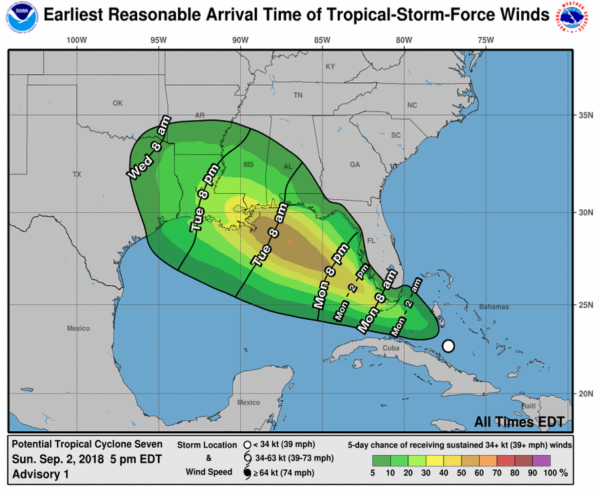
A tropical storm watch has been issued for the Alabama Gulf Coast, and points west to near Morgan City, Louisiana. A tropical storm (the name will be Gordon) is expected to form over the Gulf of Mexico within the next 24 hours.
Here are the key messages for the potential impact to Alabama…
THREATS: The primary threats for the coast will come from heavy rain and flooding, and rip currents. Rain amounts of 3-5 inches are likely for Mobile and Baldwin counties. The tornado threat seems low for now, but not zero. Gordon is expected to be a tropical storm when it moves inland Tuesday night with sustained winds of 60 mph; winds on the Alabama coast could gust to 50 mph in a few spots. But again, flooding is the primary concern.
TIMING: The center of Gordon is expected to move into Southeast Louisiana, near the mouth of the Mississippi River, Tuesday night. Heaviest rain and the main flood threat for the Alabama Gulf coast should come Tuesday night and Wednesday. Gusty winds will arrive on the coast during the day Tuesday.
Conditions will improve along the coast Thursday/Friday.
INLAND IMPACT: There will be a sharp gradient in rain across Alabama. Heaviest rain in the state will most likely be south of a line from Butler to Monroeville to Florala. North and East Alabama, most likely, will see little rain as a direct result of Gordon. The main threat of flooding will be over Mobile and Baldwin counties of far Southwest Alabama.
UNCERTAINTY: Remember, this is now a “potential tropical cyclone”, not a depression or storm. This means there is greater uncertainty in the forecast, so be prepared for changes. Once a low level center is established and the system gets better organized, forecast confidence will be higher.
Keep an eye on the blog for updates…
Category: Alabama's Weather, Tropical


