A Quick Check On Our Weather At 11:10 AM
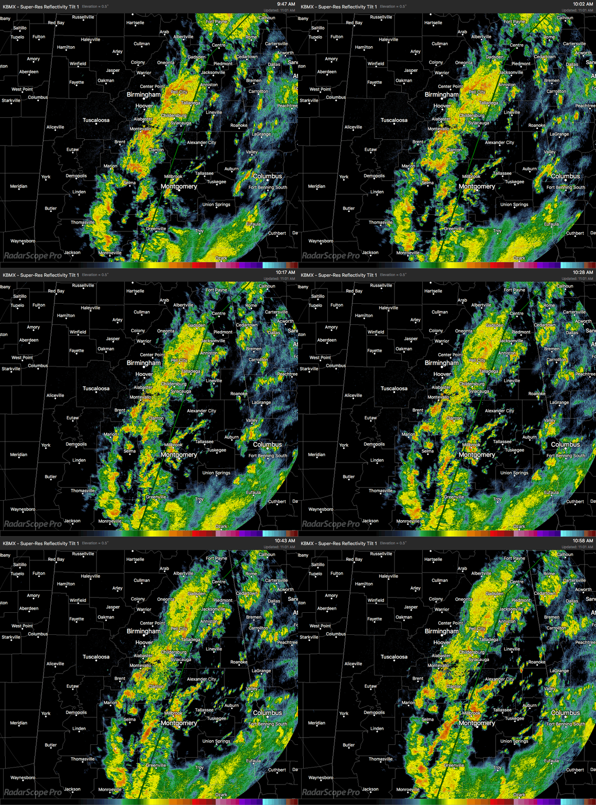
RADAR CHECK AT 11:00 AM: Much of the shower activity, some of which is moderate to heavy, continues to move over the same areas that have seen plenty of rain in the past 24 hours. Unfortunately, that trend looks to continue throughout the remainder of the day and into the late night hours. The highest coverage of rain will be east of a line from Orrville (Dallas Co.) to Alabaster (Shelby Co.) to Snead (Blount Co.), while the weather is rather quiet at this point west of that line. Temperatures are running from the lower 70s to the lower 80s, thanks to the cloud cover and rain cooled air.
We already have reports coming in of impassable roads due to flood waters in Centre (Cherokee Co.), especially CR-35, Hardwood Drive, Sewell Ferry Road, CR-22 at the bypass, CR-65, and CR-76 close to CR-69. That is especially no surprise considering the amount of rain that has fallen in the last 24 hours in that community.
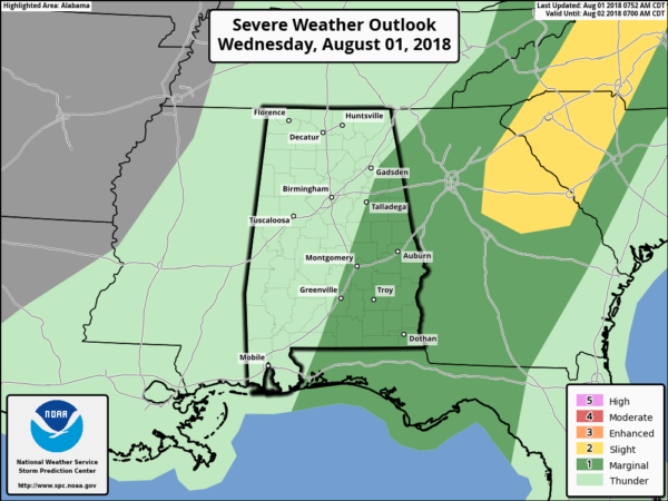
MARGINAL RISK FOR SEVERE STORMS FOR PARTS OF THE AREA: The Storm Prediction Center has much of the eastern half of Central Alabama defined in a Marginal Risk for severe storms throughout the day (locations along and east of a line from roughly Fort Deposit (Lowndes Co.) to Sylacauga (Talladega Co.) to Hokes Bluff (Etowah Co.) to Gaylesville (Cherokee Co.). Isolated damaging wind gusts will be the severe threat, but heavy rains over the same locations will be the larger impact that could lead to more flooding issues.
FLASH FLOOD WATCH IN EFFECT UNTIL 7:00 PM THURSDAY: NWS Birmingham continues the Flash Flood Watch as the threat for cell training is present throughout the remainder of the day. Flash flooding does appear to be likely as either from the long duration of sustained rainfall over the same areas or from a quick heavy downpour from a stronger thunderstorm, especially in the areas that received heavy amounts of rainfall on Tuesday.
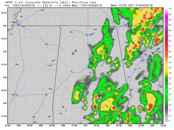
WHAT THE HIGH-RES MODELS HOLD FOR US TODAY: The above image is valid at noon today from the HRRR Simulated Radar, and as you can see rainfall will continue to occur over the same areas where the Flash Flood Watch is in effect. Unfortunately, this trend continues throughout the remainder of the daytime hours. The good news is that much of this activity dissipates during the late night hours, but a few showers may linger around during the overnight, especially in the southeastern corner of the area.
Also, the trend shows that much of the western half of the area will remain dry, but a few scattered showers and storms are possible, around 30-50%. This also means that temperatures will be much cooler across the area than what we would normally see in August due to the cloud cover and the rain-cooled air. Highs will only get up into the upper 70s to the mid-80s from east to west.
WE’LL KEEP YOU UP TO DATE THROUGHOUT THE DAY: I’ll have updates throughout the day. If any warnings or advisories are issued for any part of North and Central Alabama, those will be posted immediately after they are issued by the National Weather Service. Keep checking back often.
Category: Alabama's Weather, ALL POSTS


