Saturday Morning Notes On Alberto
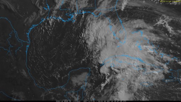
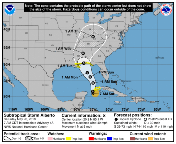
ALBERTO UPDATE: Alberto remains a subtropical storm this morning given its sprawling structure and involvement with an upper-level trough. Sustained winds are 40 mph.
Here are the key points you need to know….
*The system should become better organized tomorrow, becoming a tropical storm. Some strengthening is possible, but the system is still expected to remain below hurricane strength.
*Landfall is expected Monday night near Perdido Key. The primary impact will be along and east of the circulation center.
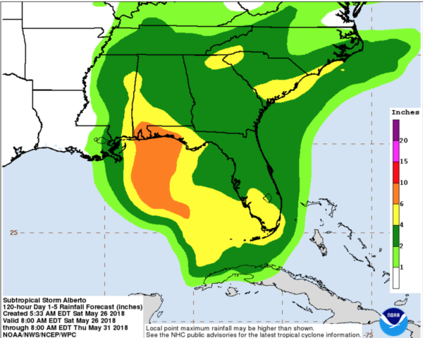
*Heavy rain, flooding, and rip currents remain the primary threat from Alberto. Red flags will continue to fly through at least Monday on the coast; do not get in the Gulf waters.
*On the coast from Gulf Shores east to Panama City Beach, the main rain shield associated with Alberto will come Monday and Monday night. Rain amounts of 6-10 inches are possible. Winds around Gulf Shores, Orange Beach, and Pensacola Beach could gust as high as 40/50 mph at times Monday night.
*A few isolated short lived tornadoes are possible on the Gulf Coast Monday afternoon and Monday night.
*For North/Central Alabama, the main rain associated with Alberto will come Tuesday and Wednesday; rain amounts of 2-4″ are likely. There is a low end threat of a few isolated, short lived tornadoes Tuesday.
*The weather on the Gulf Coast will improve during the day Tuesday, and on through the rest of the week with just the routine chance of scattered storms and a decent amount of sun each day.
Just remember to keep an eye on potential forecast changes as Alberto gets closer to the coast. Today and tomorrow will be pretty nice for places like Gulf Shores, Destin, and Panama City Beach with only a passing storm from time to time and a good bit of sunshine.
Category: Alabama's Weather, ALL POSTS, Tropical


