At 9:55 PM, Strong To Severe Storms Continuing To Move Eastward Toward Central Alabama
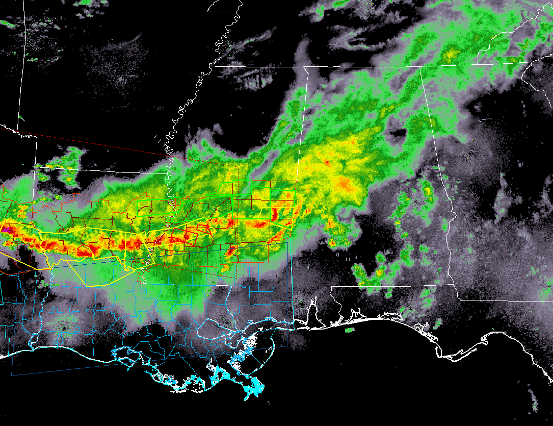
Showers and storms continue to push into Central Alabama from the west, but the good news is that we have no severe storms and we are receiving some much needed rain. We do have active storms back to our west as there are two tornado warnings in effect in southwestern Mississippi, and several severe thunderstorm warnings for southwestern Mississippi into central Louisiana and eastern Texas.
We continue to have a low risk for strong to severe storms over the southern locations of Central Alabama for the remainder of tonight and into the early morning hours on Saturday. The main threat will be from isolated damaging wind gust up to 60 MPH, with a much smaller threat of a brief spin-up tornado.
The threat for strong to severe storms will be south of a line from Geiger to Wetumpka to Fort Mitchell, while the threat for a brief spin-up tornado along with the damaging winds will exist south of a line from Livingston to Selma to Hayneville.
The main window for strong to severe storms will be from now until 4:00 AM for the western half of the threat area, and from 3:00 AM to 9:00 AM for the eastern half.
At this point, there has been no word on the issuance of a watch for the southern parts of the area.
Atmospheric conditions continue to show less than favorable conditions across Central Alabama on the latest analysis. There is virtually no surface-based instability located in Central Alabama, with the only instability showing up in the state in the extreme southern parts of the state near the Florida state line and down to the gulf.
We have decent low-level helicity values, so the possibility for a stronger storm to start rotating is present, therefore the mention of a small threat of a brief spin-up tornado.
Another limiting factor is the available moisture across the area. Dewpoints are running in the mid-40s to the upper 50s, with the higher values along the state line in the southwestern parts of Central Alabama. Those values will start to creep upwards in the extreme southern parts of the area, making it into the low 60s by midnight. This may cause enough destabilization for thunderstorms to keep some of their strength and lead to a strong to severe storm.
For locations north of a line from Geiger to Wetumpka to Fort Mitchell, severe weather is not expected, including the cities of Birmingham, Tuscaloosa, Anniston, Gadsden, Clanton, Alexander City, Cullman, Hamilton, and Jasper. Storms will more than likely be elevated which will possibly lead to some loud thunder and locally heavy rainfall.
We will continue to keep you updated throughout the remainder of tonight and throughout the pre-dawn hours of Saturday.
Category: Alabama's Weather, ALL POSTS
About the Author (Author Profile)
Scott Martin is an operational meteorologist, professional graphic artist, musician, husband, and father. Not only is Scott a member of the National Weather Association, but he is also the Central Alabama Chapter of the NWA president. Scott is also the co-founder of Racecast Weather, which provides forecasts for many racing series across the USA. He also supplies forecasts for the BassMaster Elite Series events including the BassMaster Classic.Subscribe
If you enjoyed this article, subscribe to receive more just like it.


