A Look At The Alabama Severe Weather Threat
This is mid-March in Alabama, so having a severe weather threat is what we expect this time of the year. We will have an active pattern through tomorrow night.
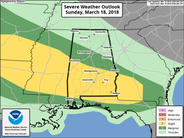
TODAY/TONIGHT: SPC has defined a severe weather threat for the southern half of Alabama this afternoon and tonight, close to a stalled surface front.
Storms over South Alabama could produce strong gusty winds and perhaps some small hail; the tornado threat is low, but not zero. As the front lifts northward tonight, rain will increase over North Alabama, but the severe weather risk north of I-20 (Tuscaloosa to Birmingham to Anniston) is rather low.
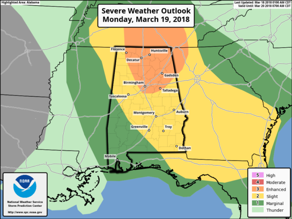
MONDAY/MONDAY NIGHT: This is the time of greatest concern as the surface boundary lifts into southern Tennessee, pulling moist, unstable air into the northern half of our state. SPC has defined an “enhanced risk” of severe storms for parts of North and Northeast Alabama, with standard “slight risk” down to Aliceville, Camden, and Andalusia…
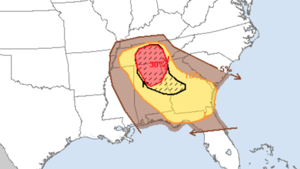
The probabilistic outlook from SPC suggests there is a 30 percent chance of severe weather (large hail, damaging winds, or a tornado) within 25 miles of any given point in the enhanced risk area.
It is important to note the severe weather risk is somewhat conditional; it depends on how the atmosphere looks after the rain we see tonight and early tomorrow. But, there is general consensus in model output that instability and shear profiles will be favorable for severe storms.
TIMING: The main window for severe thunderstorms in Alabama tomorrow will come from 3:00 p.m. until 10:00 p.m.
THREATS: Storms that form tomorrow will have potential for strong straight line winds, large hail, and a few tornadoes. The highest tornado threat will be in the “enhanced risk”, where wind profiles will be most favorable. But, a tornado or two certainly can’t be ruled out in the “slight risk” area as well.
RAIN: Rain amounts will be fairly variable, but most places will see 1/2 to 1 inch, not enough for flooding issues.
CONFIDENCE: The confidence level is medium; we need to see the state of the atmosphere tomorrow morning before confidence in the forecast is really high. Once we get the upper air data back early tomorrow we will have a very good assessment of the situation.
As I stated at the top of this post, severe weather threats are VERY common in Alabama in March, April, and May. There is absolutely no need to be fearful, just be prepared.
*Be sure you can hear warnings if needed. NEVER rely on an outdoor warning siren; if that is your main way of hearing warnings, you have little hope of hearing them indoors. Have a NOAA Weather Radio in your home or business, and a good app designed for warnings on your smart phone like WeatherRadio by WDT.
*Know the safe place in your home. Small room, lowest floor, away from windows, and near the center of the house. If you live in a mobile home, you have to leave and go to a shelter or site built structure.
*In your safe place, be sure you have a helmet for everyone to wear (not just children)… it is also good for everyone to have a portable air horn, and be sure and wear hard sole shoes.
Stay tuned to the blog for updates!!
Category: Alabama's Weather, ALL POSTS


